A beautiful sunrise with orange and red highlights greeted us Saturday morning when we woke up at the Desous campground. We made coffee and breakfast and got packed up. Before departing, we ventured out to explore the surrounding mountain bike trails.
Mountain biking trails at Desous campground
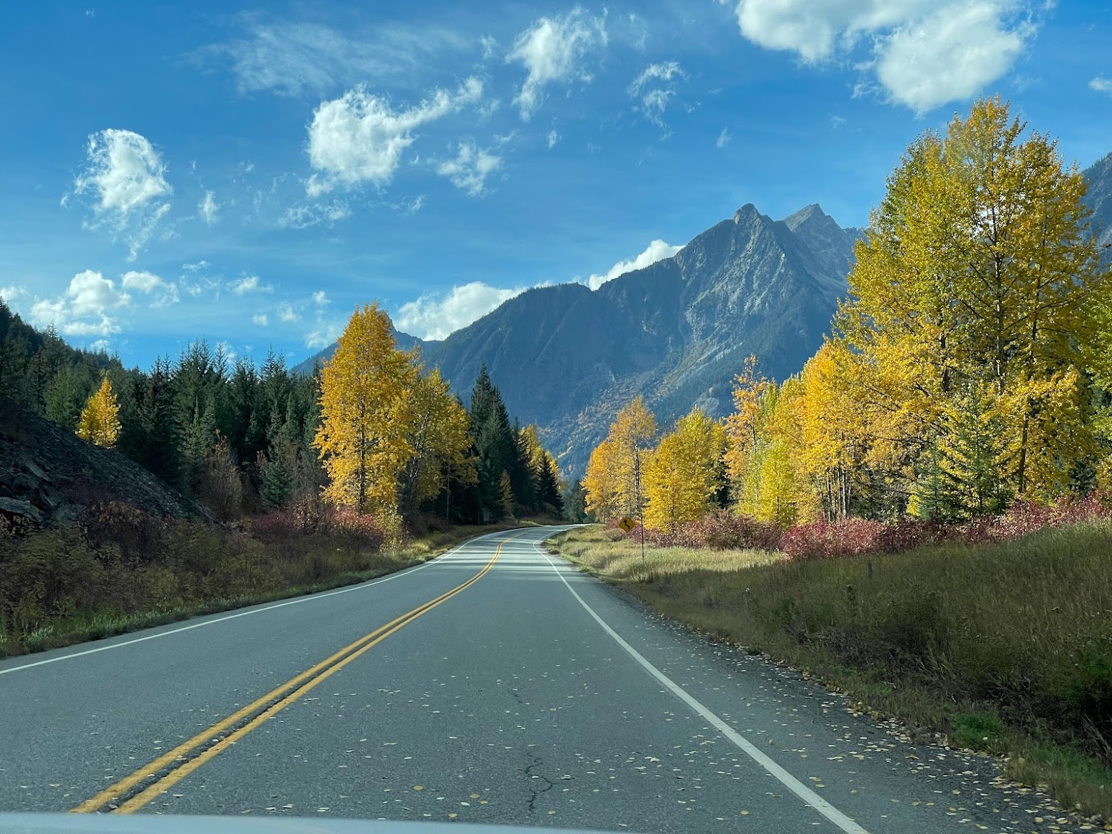
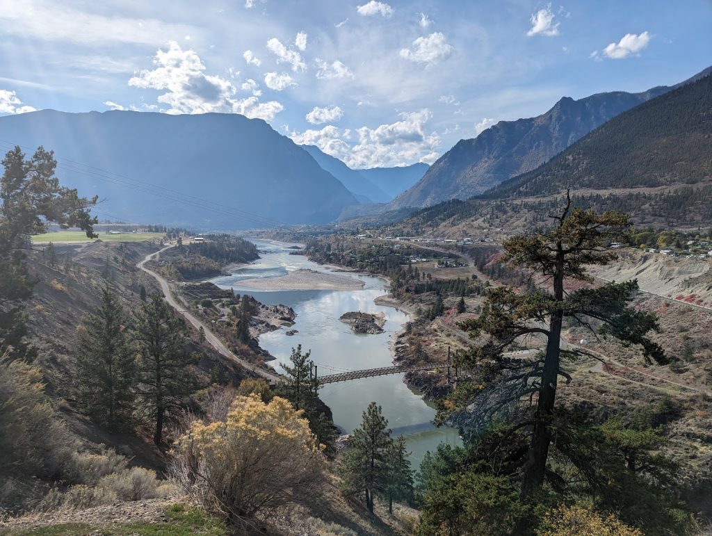
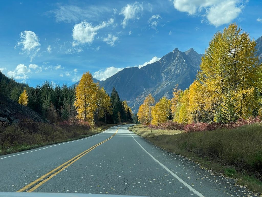
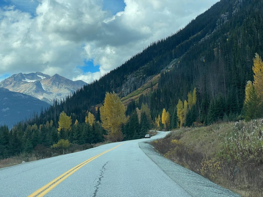
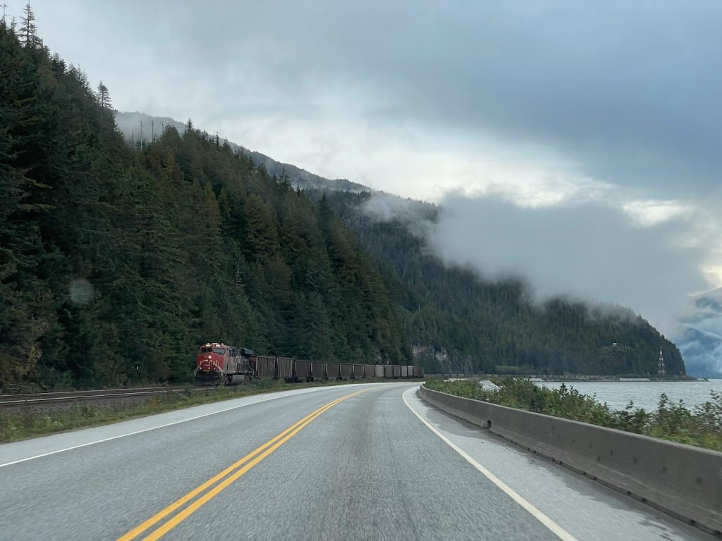
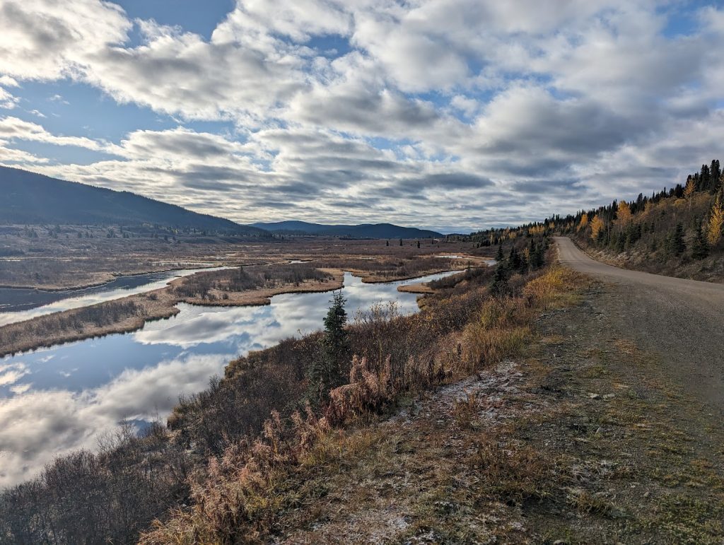
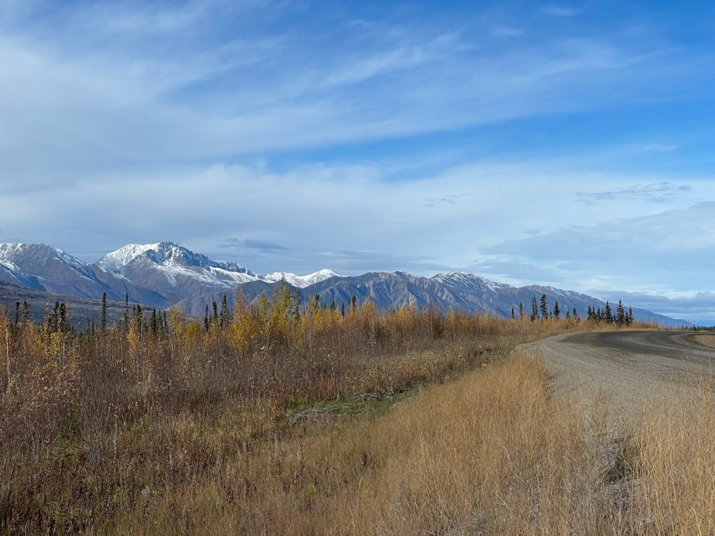
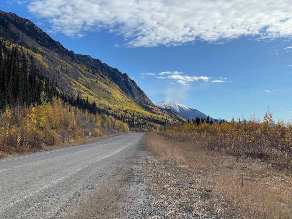
We got back on the road and continued south on route 97 toward Cache Creek. Just before approaching Cache Creek, we veered west onto route 99 to explore the more mountainous route to Vancouver. The road twisted, curved, and wound all around through several mountain passes, and the views were spectacular.
Viewpoint overlooking the community of LillooetBeautiful fall colors along the Sea to Sky Highway (BC-99)Impressive logjam at Duffey LakeMore stunning scenery along the Sea to Sky Highway (BC-99)
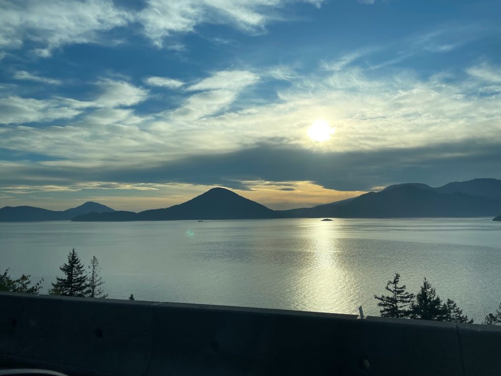
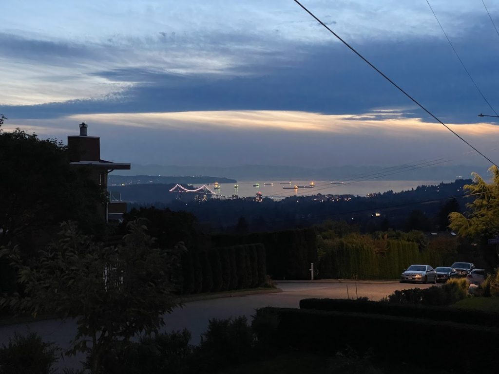
We passed through Whistler and Squamish and as we neared Vancouver, the highway hugged the coastline, revealing views of Howe Sound.
Views of Howe Sound appear along BC-99 just north of Vancouver
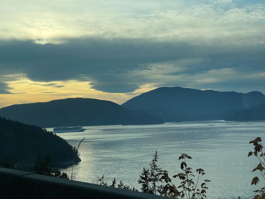
The sprawling city of Vancouver is quite a contrast to the rural and rugged parts of northern British Columbia. After several nights camping, we treated ourselves to an AirBnB in North Vancouver for a night and explored the city! We walked to Pawan’s Kitchen for a late dinner and enjoyed the fast-paced hustle and bustle of a big city. After a longer day on the road, it was nice to relax and enjoy the amenities of an AirBnB. Tomorrow we cross the border into Washington and visit Olympic National Park!
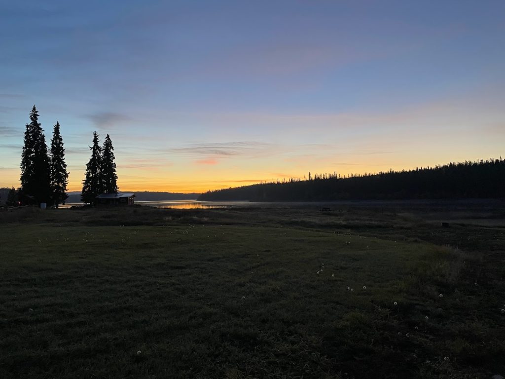
We woke up Saturday morning to an incredible sunrise on Ootsa Lake! Our alarm included lots of squabbling Canadian Geese and loons calling in the distance. It was perfect. We were so thankful to have such amazing weather.
Dawn breaking over Ootsa Lake, BCSaturday morning on Ootsa Lake, BC
After breakfast, we packed up camp and got back on the road. Nathan was so helpful in giving us directions on how to best navigate the backroads and get back onto the Yellowhead Highway. After a bad wildfire season, several nearby roads had been closed but thankfully he confirmed that his wife Gwyn had just driven them yesterday and knew the route we wanted to take was open.
Coffee & eggs for breakfast Residual fires along the road on the way from Ootsa Lake to Vanderhoof
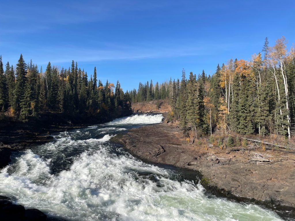
An hour after departing Ootsa Lake, we were still on backroads making our way toward Vanderhoof. We passed a raging waterfall along the impressive Cheslatta River. Several other people were up early arriving to hike the Cheslatta Falls trail.
Cheslatta River and waterfallLast stretch of dirt road before getting back on the Yellowhead Highway
By the afternoon, we arrived in Prince George and made a stop at Deadfall Brewing. Without realizing it, we had stumbled upon the happening event in town that day. As we walked through the door we saw the room was packed, and wondered what the occasion was. Before we could ask, it became apparent through the blaring Taylor Swift music playing overhead and the tangible excitement of everyone packed in around tables pouring over containers of beads. We finally realized: everyone was making friendship bracelets and rocking out to Taylor Swift because it was Swiftie Saturday! This event drew everyone in – grandparents, parents, young kids, college students, friends – a range of all ages. The bartender knew there was limited seating and insisted we share a table with two of her students; she was sure they wouldn’t mind. We sat down an introduced ourselves to two women who were intently focused on their bracelet making, but excited to meet new faces. Both were exchange students attending the University of Northern British Columbia for the semester – Dana lives in New Zealand and Trinity lives in Australia. We talked for a while about school, travels, hobbies, and the coming winter. We also learned more about their experiences as exchange students in Prince George. One of the best things about travel is you never know who you will meet! As we departed, we thanked them both for letting us crash their table and wished them well.
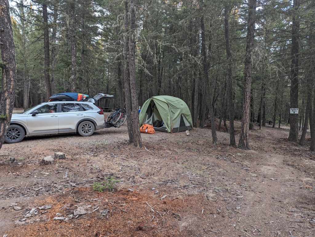
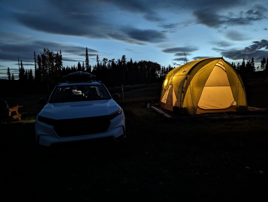
Prince George concluded our time on the Yellowhead Highway and we would now start to make our way south toward Vancouver. After a few more hours driving, we reached Williams Lake. Tim found a fantastic campground on Desous Mountain and surprisingly we had the whole place to ourselves!
Campsite on Desous MountainCamp fire at Desous Mountain campground
We concluded the day with a meal and enjoyed the warm campfire while admiring a sky full of stars. The Milky Way was distinctly visible and streaked across the sky. Our days in British Columbia are quickly dwindling and soon we’ll be back in the states. We have loved every minute in this beautiful province!
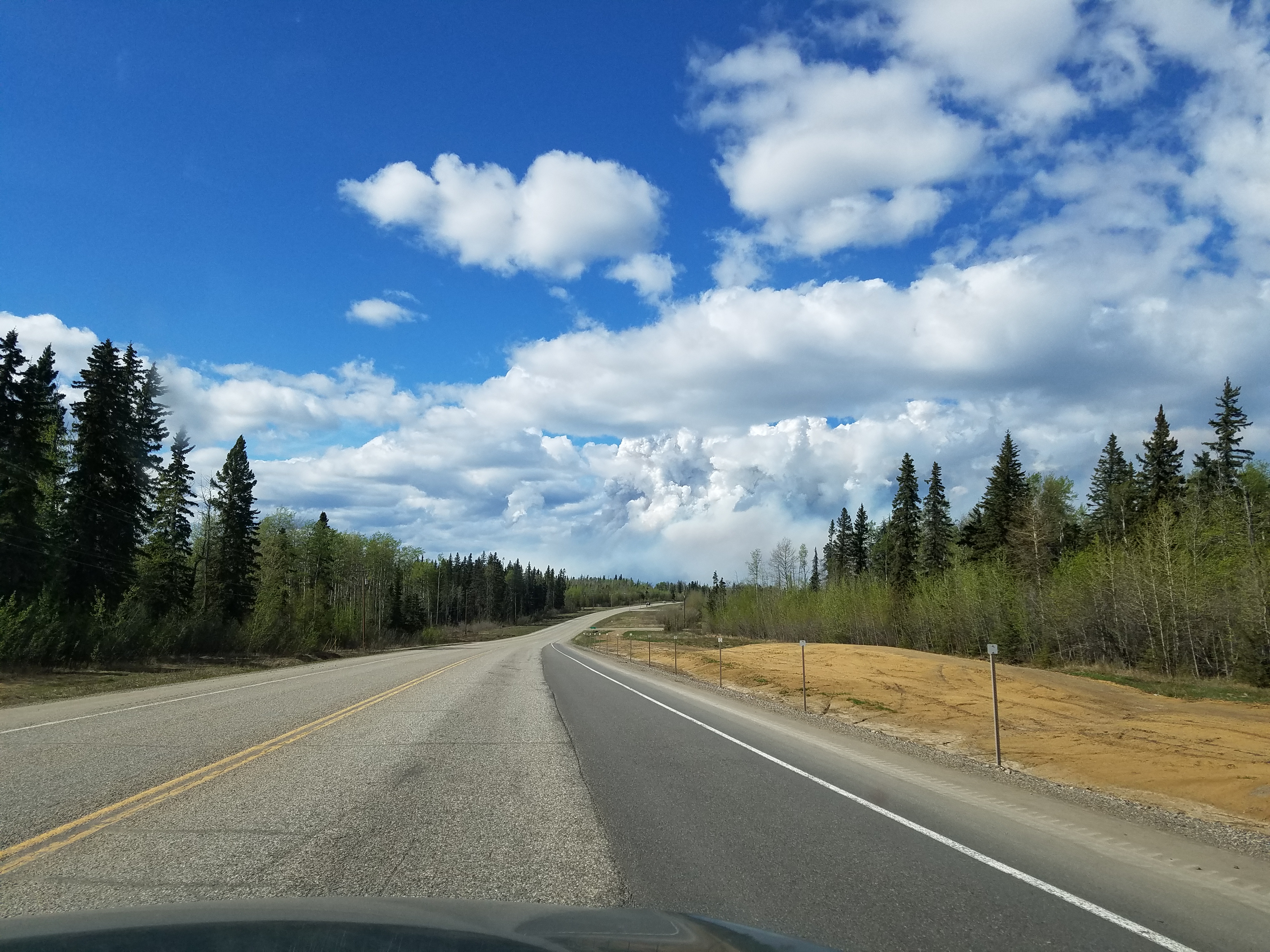
We finished driving the Cassiar on Thursday October 5 and continued driving south on the Yellowhead Highway. Views along the southern end of the Cassiar had changed from what we observed along the northern half – much denser forests and increased logging activity, but the fall colors still stood out. Our next destination was a side trip to Prince Rupert. After a soggy night in Stewart, we decided to treat ourselves and book a night at an AirBnB. Because it was a last minute booking, it was discounted 50% – can’t say no to that!
The drive to Prince Rupert was stunning. It reminded us of driving along Turnagain Arm, though it was much longer! We followed the winding road along the Skeena River and were surrounded by mountains the whole way with waterfalls abound. One highlight mentioned in the Milepost was “carwash rock”. A giant boulder protruding out of the mountainside hung over the road and water cascaded down, splashing cars passing underneath.
Scenic, winding road to Prince Rupert following the Skeena River
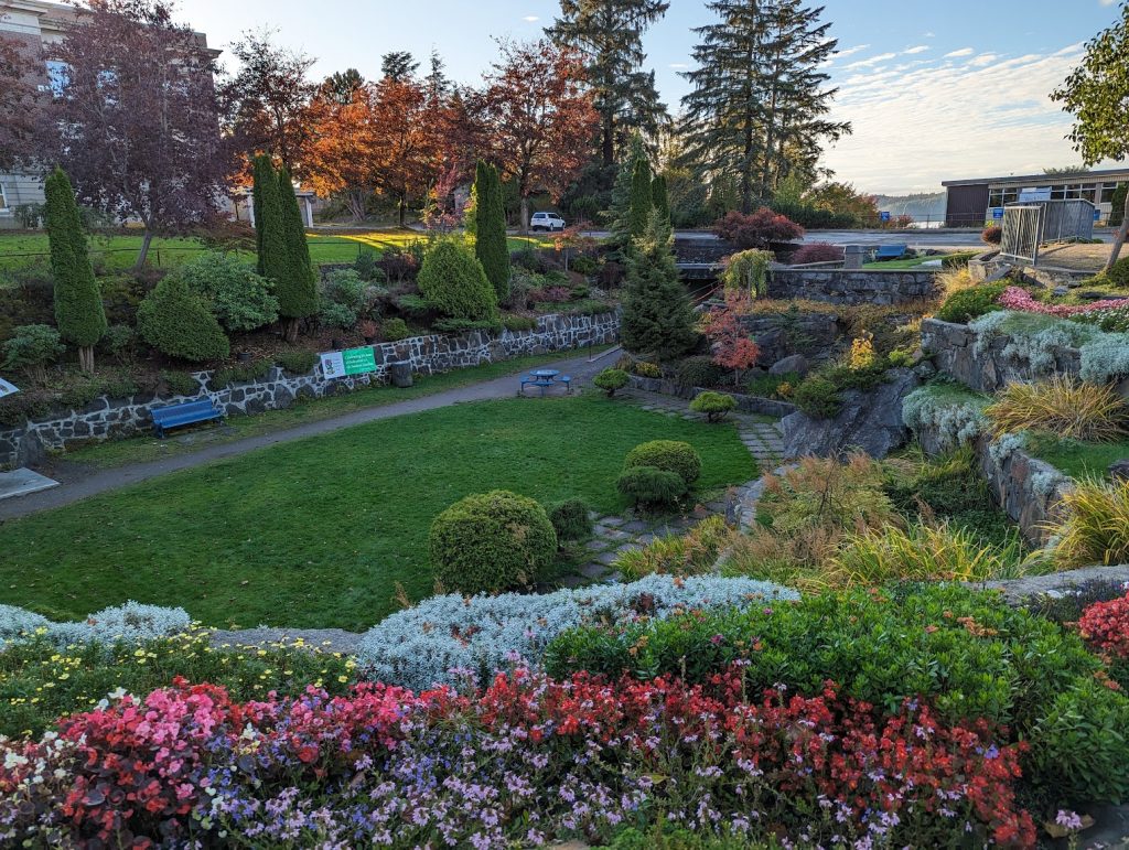
We reached Prince Rupert by 4:30 in the afternoon and checked in to our AirBnB. It was a great neighborhood within walking distance to downtown. After showering and reorganizing our bags, we headed out to explore and find a spot for dinner. Along our walk to downtown, we stumbled upon the beautiful Sunken Gardens and stopped to admire the hard work of the local garden club.
Sunken Gardens in Prince Rupert
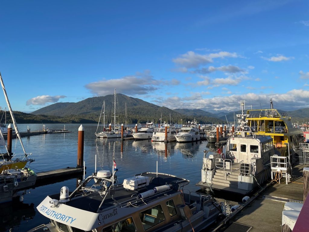
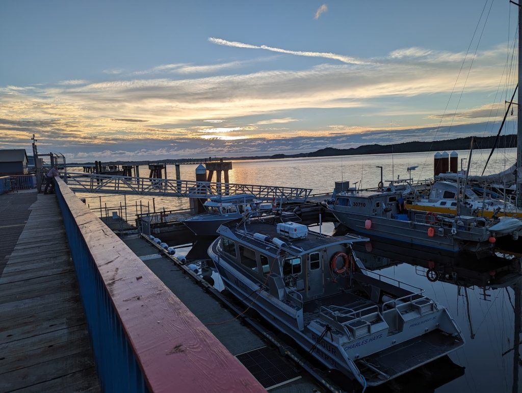
We lucked out with perfect weather and a beautiful sunset. After a delicious sushi meal at Fukasaku, we walked around the harbor and took in the views. Our next stop was the old train depot on the water which had recently been converted into Wheelhouse Brewing Company. Several locals were out enjoying the evening and soaking up the sunset. We found a spot outside in the beer garden and watched as dusk colors filled the sky and the first stars became visible. Prince Rupert sure is a scenic coastal town with a great small town vibe!
Walking along the harbor in Prince Rupert, BCSunset at the harbor in Prince Rupert, BCA real local perched on the rooftop of a bed & breakfastWheelhouse Brewing Company in the old train depot
The next morning our AirBnB host Andrea was up early making breakfast. We joined several other guests in the adjacent kitchen and were treated to delicious local coffee, homemade toast, and eggs. After we thanked her for an awesome meal and said our goodbyes, we got packed up and back on the road by 8 to make our way back to Terrace. In the midst of packing and loading up the car, Tim inadvertently left his raincoat on the roof, and neither one of us noticed. It wasn’t until we reached Terrace that he remembered he had put it there. Oh no! All we could hope for was that someone who needed it in Prince Rupert found it and it fit perfectly. We also instituted a new rule before leaving anywhere: always check the roof!!
The returning views along the Skeena River were just as grand. And this time a coast-bound train chugged past us, giving the scene an even more Turnagain Arm-like effect.
Coast-bound train along the Skeena River
We continued east on the Yellowhead Highway, (following the Skeena River all the way inland!) and stopped in Hazelton around midday. In between Old Hazelton and New Hazelton is the Hagwilget Canyon Bridge. With the leaves changing colors, we were treated to some spectacular views. (The foliage really has been a major highlight of this drive!)
Hagwilget Canyon Bridge near Hazelton, BC
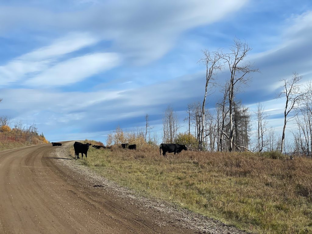
After a quick break for lunch, we continued for another couple of hours on the Yellowhead through several small towns including Witset and Smithers. Just before reaching Houston, we veered south onto a dirt Forest Service Road. Tim had chosen this next adventure and assured me he had done plenty of research. Our destination for the night was the Ursa Minor Brewing Company on Oosta Lake, a 5 star location according to Google reviews. Not only did it offer homebrews, but also farm animals, campsites, lake views, and since it was Friday, they served food too. (Leave it to Tim to find the most remote, rural breweries in the middle of nowhere!) After nearing the second hour of driving down this rural dirt logging road, I asked again if he thought we were going the right way. Before he could answer, a sign appeared on the right hand side of the road. It read, “Brewery” with an arrow pointing in the direction we were going. What a moment!
Dirt logging road on the way to Ootsa LakeLots of free-range cows on the way to Ootsa Lake
Another hour passed, and several more signs were posted along the way, encouraging us that we were on the right path to the Ursa Minor Brewing Company. We pulled up to the entrance and made our way down a long and narrow driveway.
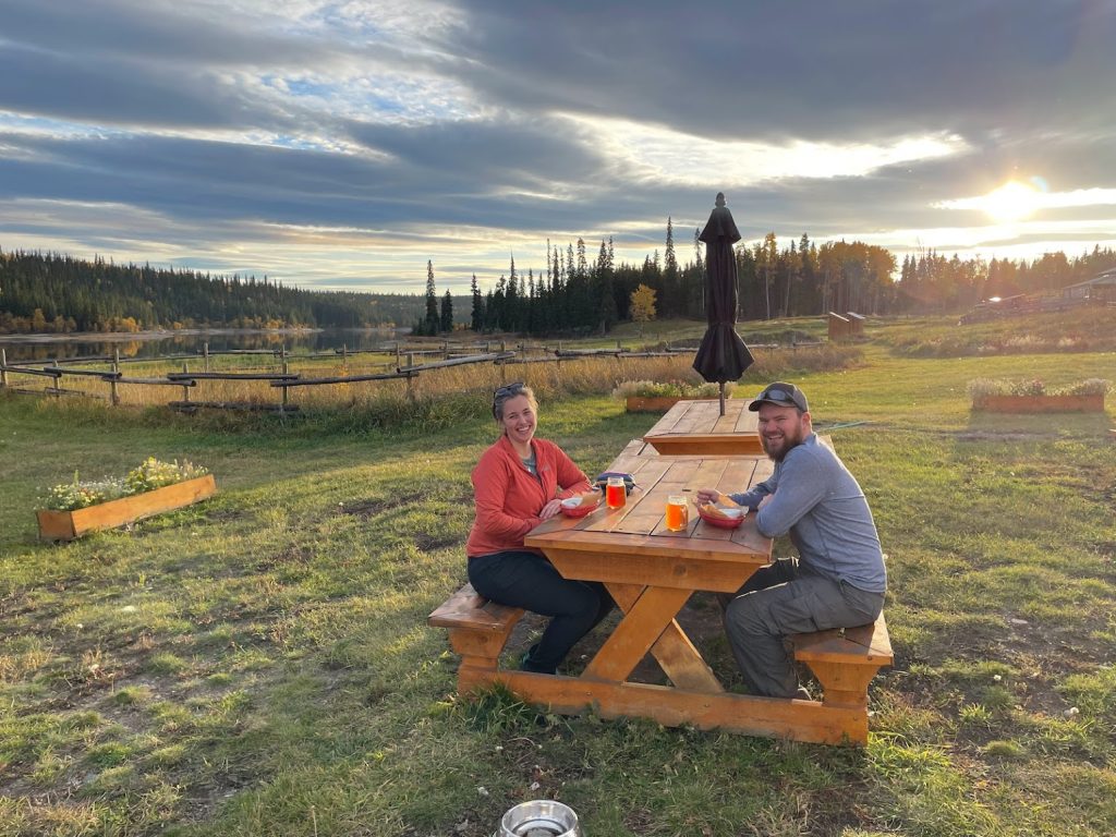
The property was incredible! Owners Nathan and Gwyn live here and not only run the brewery, but also tend to several farm animals. They also have a marvelous garden, and frequently incorporate their harvests into beer recipes as well as meals served in the tasting room.
Great brews and views at Ursa Minor BrewingWilson the brewpig (he has his own instagram!)
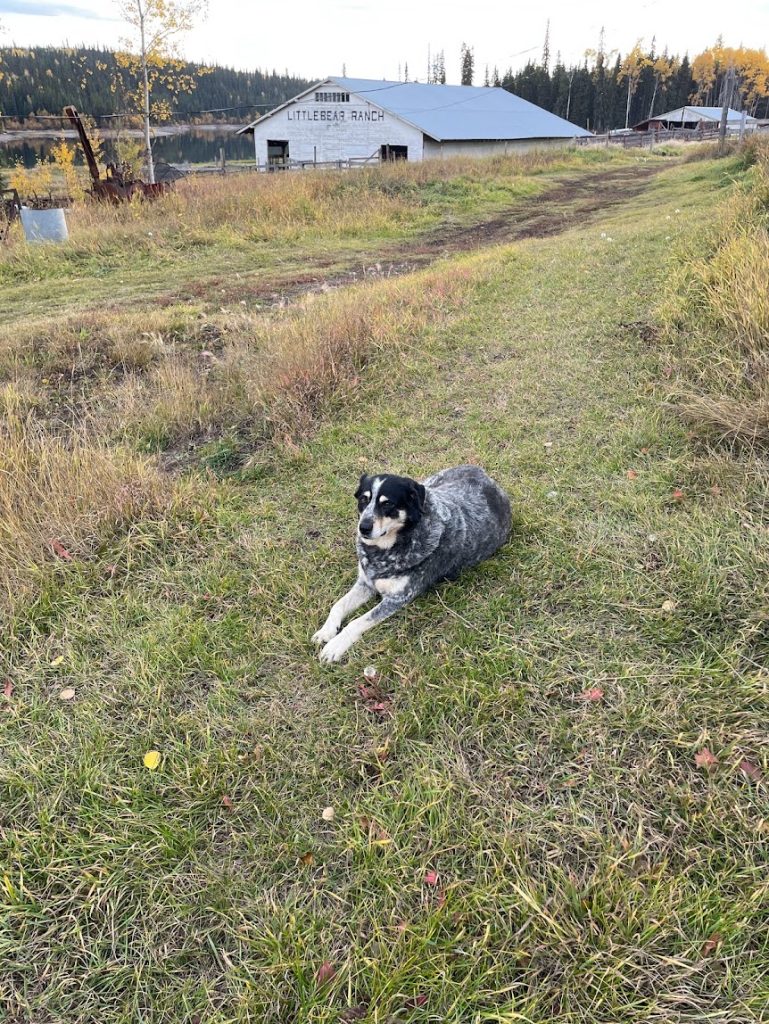
Several others had made their way to this remote spot for the evening – a group of teachers from Ontario, a couple from a nearby town, and a local pipeline worker. The atmosphere was fantastic and we had a chance to get to know Nathan, the owner. His parents lived on this property and had a dairy farm for over 40 years. After working many years in forestry, his interests shifted to brewing beer, raising farm animals, and gardening. Now he has an amazing 540-acre farm to do just that, in addition to graciously hosting campers on the property!
As the evening wore on, many guests had already departed. Soon Tim and I had the whole place to ourselves. We walked around the property and moved our car to the designated camping location, right near the lake. It was perfect! We quickly fell asleep to pure silence, interrupted only by the occasional loon calling, or Canadian geese landing on the lake.
Friday night campsite at Ursa Minor Brewing on Ootsa Lake
It turns out the long drive down dirt logging roads in the middle of British Columbia leads to an amazing place, and I’m so thankful Tim stumbled upon this gem and insisted we stop!
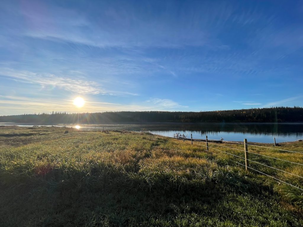
We woke up Wednesday morning and made coffee and eggs for breakfast while enjoying the lake views. Tim and I love our morning coffee and we were overjoyed to find an amazing portable coffee grinder for this trip! Paired with an aero press, it really makes every morning better. It requires a little more time and effort than brewing coffee in a kitchen, but it’s perfect for the road!
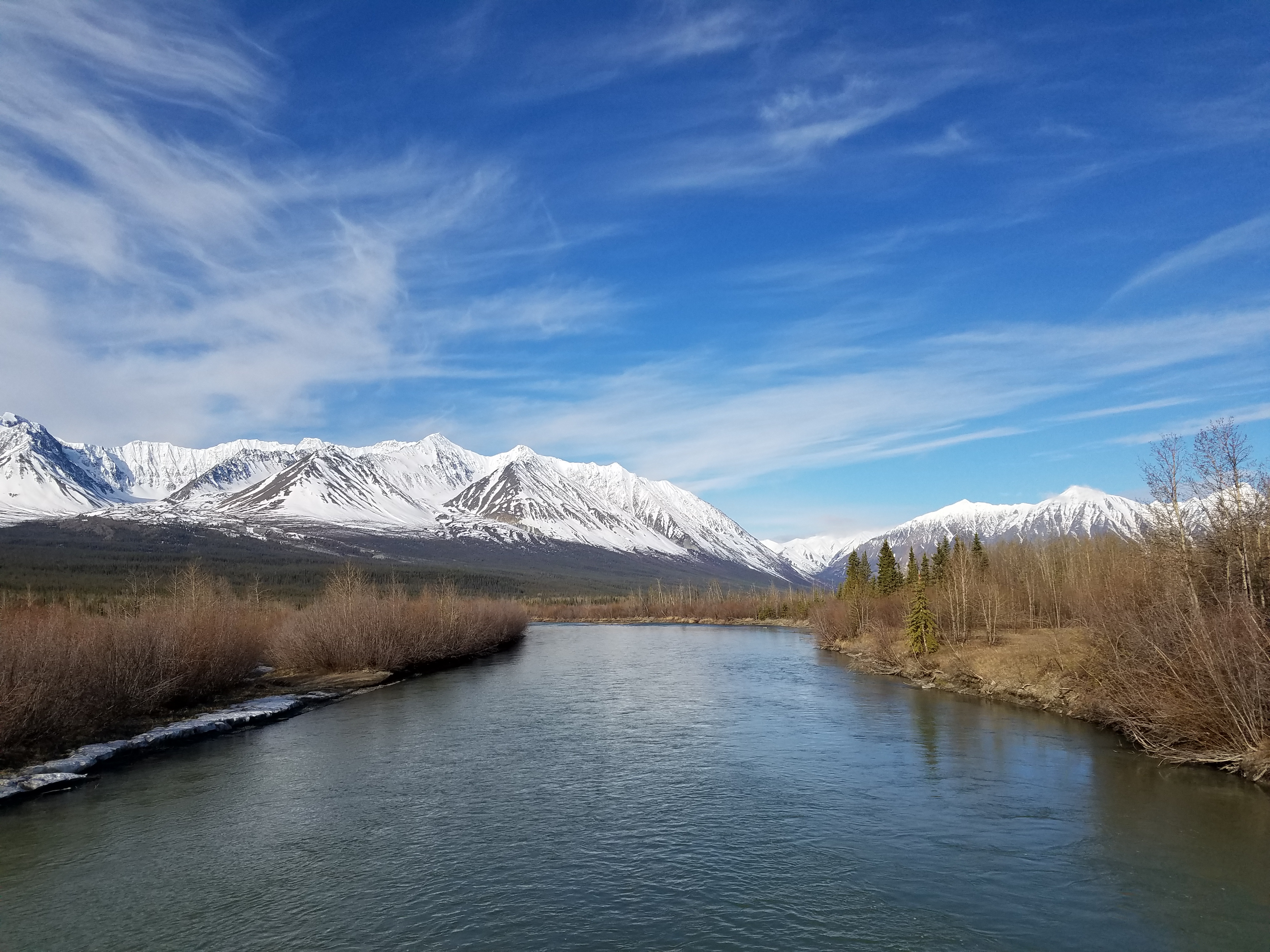
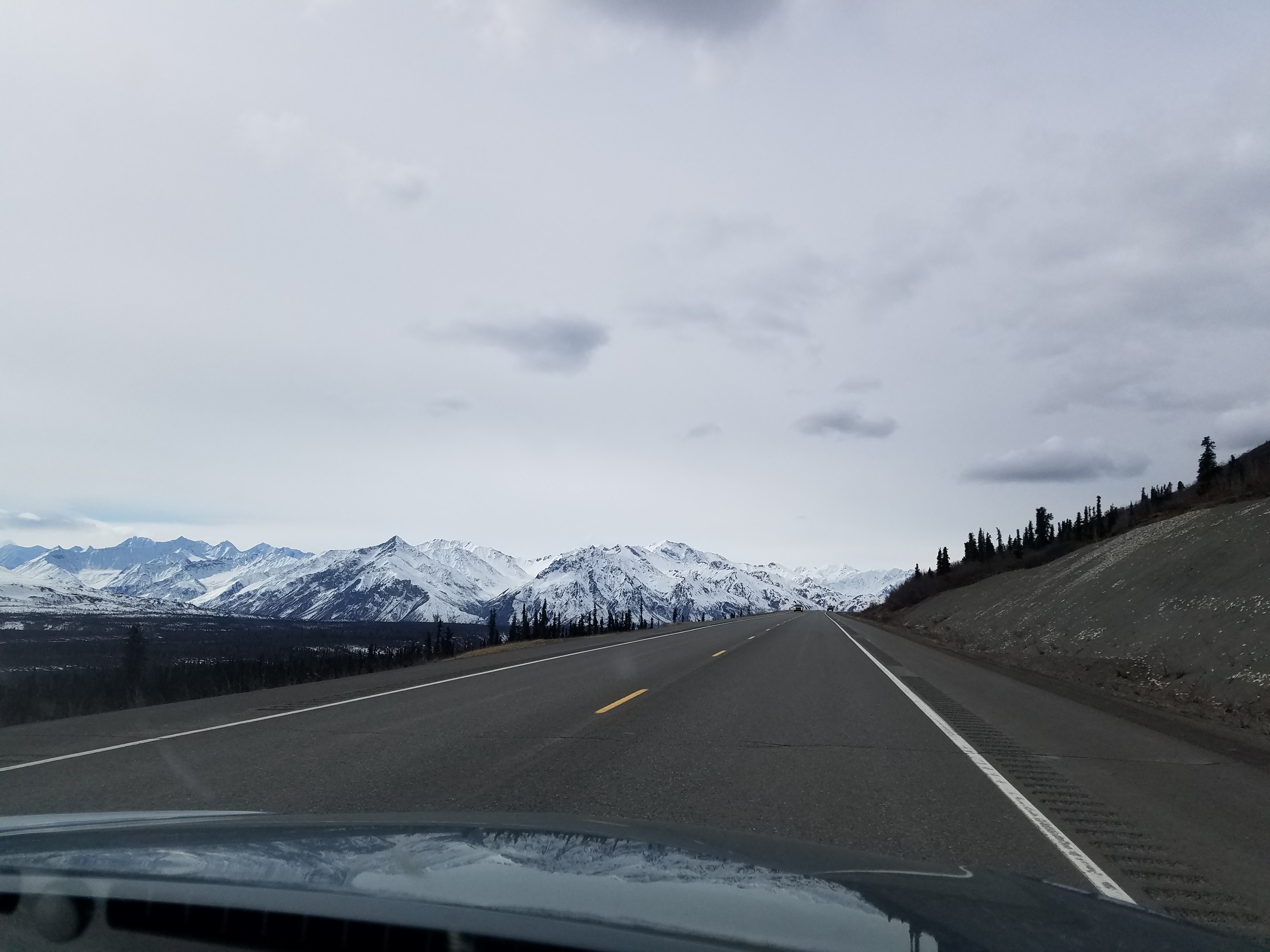
We didn’t linger and got packed up and on the road by 9am. After passing through Dease Lake, the road climbed to the highest point on the Cassiar – 4,071 feet through Gnat Pass. There was a light dusting of snow on the ground and the temperature dropped to 30 degrees. This area is so scenic! We passed Upper Gnat Lake and Lower Gnat Lake and stopped multiple times for pictures.
Upper and Lower Gnat Lakes near Gnat PassGnat Pass Summit (4,071 feet) – the highest point on the CassiarBeautiful fall foliage along the Cassiar
The road then descends into Iskut, a small community surrounded by towering mountains within the Mount Edziza Provincial Park. Later in the day as we approached Meziadin Junction, we spotted a black bear on the side of the road hastily foraging for berries.
Bear foraging for berries on the Cassiar near Meziadin Junction
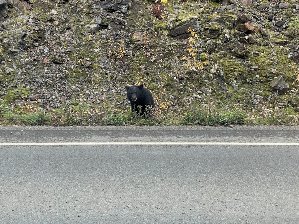
Interested in a side trip to Stewart, BC and Hyder, AK, we jogged off the Cassiar and continued on to route 37A toward the coast. A second black bear, this one much larger, lumbered across the road in front of us and quickly sought shelter in the brush alongside the road.
Big bear in the road on the way to Stewart and Hyder
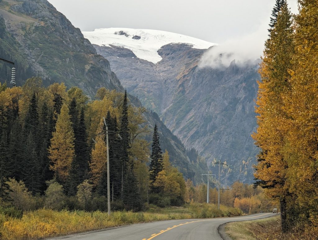
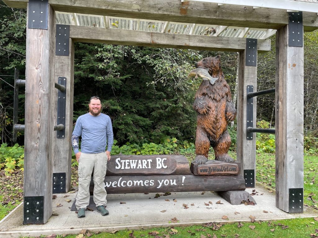
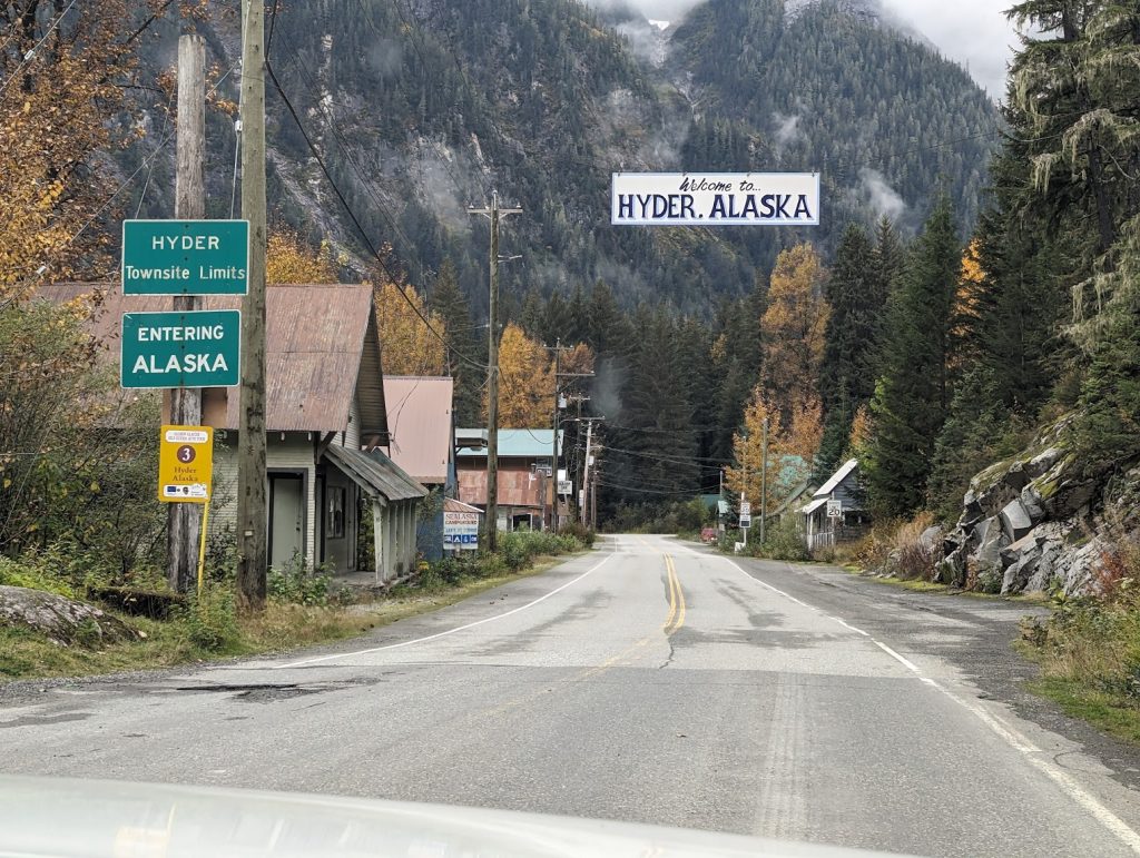
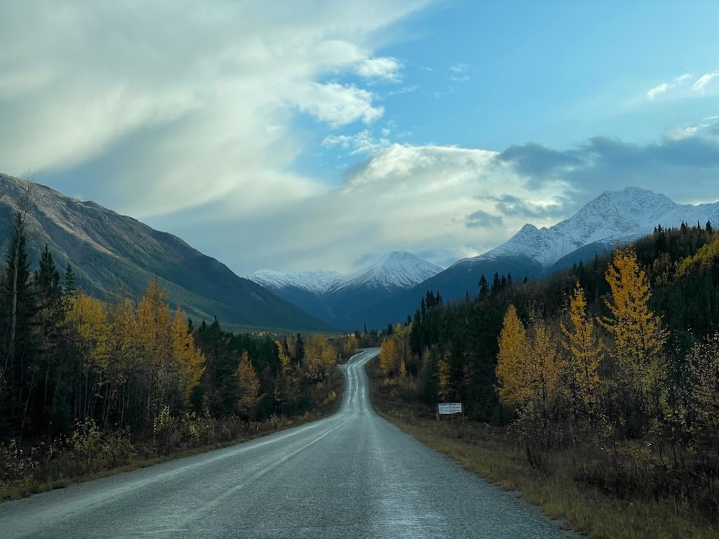
The road to Stewart is beautiful and reminded us a lot of Keystone Canyon on the way to Valdez. Towering mountains, endless waterfalls, and views of Bear Glacier were highlights. Stewart and Hyder are small communities located on the Portland Canal – a long narrow channel that eventually leads into the Gulf of Alaska. The canal also serves as the border between US and Canada, dividing Southeast Alaska from the coast of British Columbia. There are no US Customs when crossing from Stewart into Hyder, only a Canadian checkpoint when leaving Hyder and re-entering Stewart.
Mesmerizing views on the road to Stewart and HyderWaterfall alongside the road to Stewart and HyderCrossing the border into Hyder, AKPortland Canal in Hyder, AK
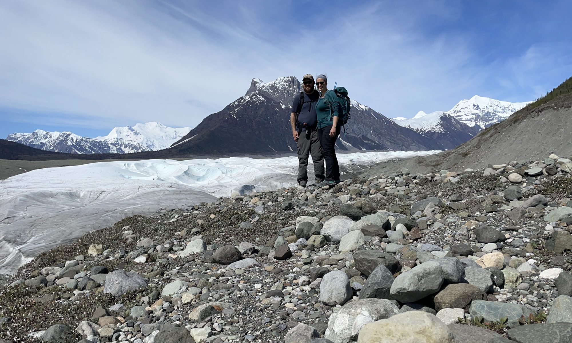
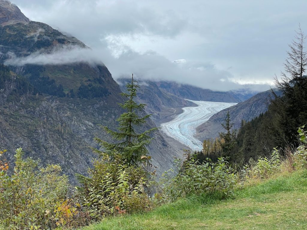
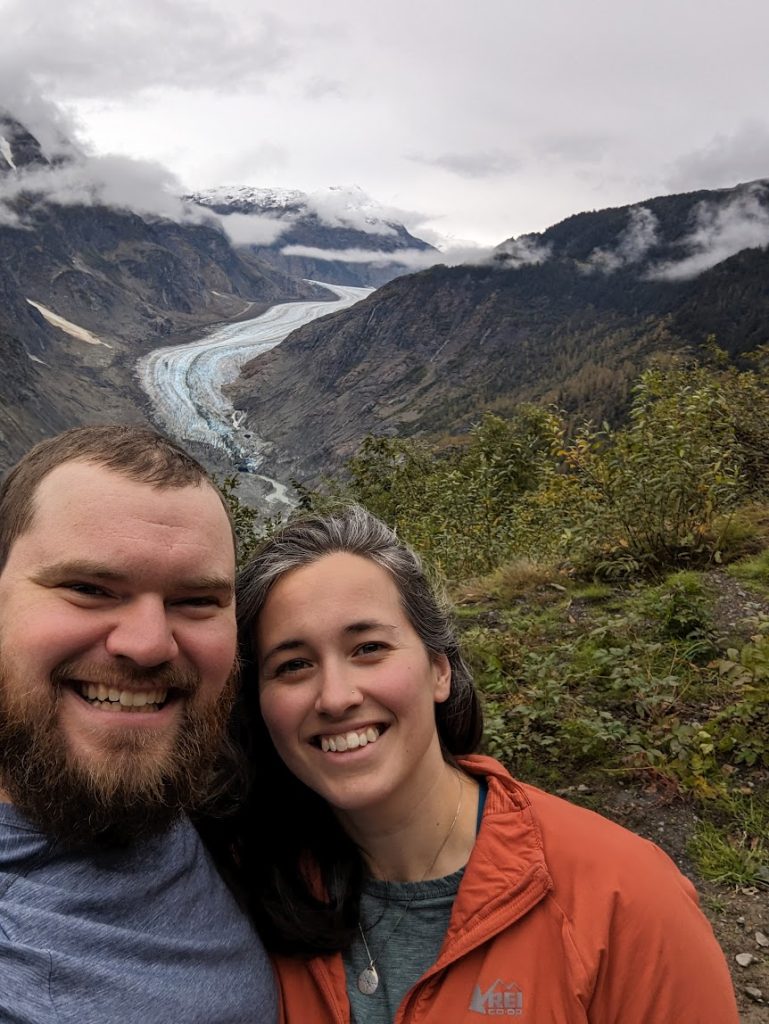
We continued into Hyder and drove down a long road paralleling Fish Creek, that ultimately leads to the Salmon Glacier. The overwhelming smell of dead fish became noticeably apparent and tons of spawned out salmon were visible in the water and on both sides of the creek. The road turned to dirt and began to climb steeply as we crossed back into British Columbia. Several signs along the way indicated there was lots of mining activity and multiple trucks passed us going down. After about 25km, we found ourselves in the middle of a clearly active mining operation (Canada’s Premier Gold Project). Despite several signs advertising stunning views of Salmon Glacier, it just didn’t seem like a good idea to continue driving through the muddy glacial silt while massive rock trucks with wheels the size of the car surrounded us. Feeling like we were clearly in the way, we carefully turned around. A miner in a pickup truck across from us saw our maneuver, pulled up alongside, and rolled down his window. “You’ve come up too far to turn around!” he exclaimed. We laughed nervously and asked how much farther it was. He pointed to a switchback on the other side of the mountain and said it was just around the bend. “Follow me through” he said. Ok, we were committed. He kindly led us through the frenzy of mining operations. We followed closely and made it to the other side. He smiled and waved and we continued on our way to the Salmon Glacier lookout. If it weren’t for his kindness and gentle encouragement, I’m not sure we would have continued up the mountainside to see the glacier. But I’m so glad we did! He was right – the glacier soon came into view after the narrow winding switchback and the lookout point is spectacular.
Spectacular views of Salmon Glacier accessed from Hyder, AK but located in BCSalmon Glacier Selfie
On the way down, we took our time navigating the road and stopped at a small gift shop in Hyder. The woman behind the counter, Carolyn, was very friendly and asked about our travels. When we told her we were leaving Alaska, she was aghast and asked, “Why would you ever want to leave the great north!?”. I laughed and explained this is a new, exciting chapter for us. We may end up back in Alaska someday in the future, but we’re excited to explore a little bit. She agreed and chuckled, “Oh yes, life is full of many different chapters…good for you.” Curious to know more, she asked what jobs we were leaving behind in Anchorage. I brought up my previous position with the National Weather Service and she immediately lit up. “You know I used to be a Cooperative Weather Observer” she said as she pulled out her B-91 record book from under the counter. I was immediately intrigued. She started showing me pages and pages of daily weather records from Hyder, most from 2010-2011, and pointed out her annotations in the remarks section about Salmon Glacier Jökulhlaup events. She then went on to talk about some extreme snowfall she had witnessed over the years (up to 4 feet in a day!).
Our short conversation reminded me that I love talking about the weather with people. For one, you never know which direction the conversation will go (I’ve definitely had some interesting weather conversations!) But more than anything, I love that it’s a common and unifying experience for all of us, and I especially love hearing from individuals about their unique experiences and observations.
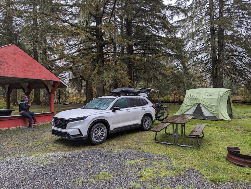
Speaking of the weather, as we said goodbye to Carolyn and departed the gift shop, the rain picked up in intensity and it started pouring. We crossed back into Stewart, BC and found a campsite at Rainey Creek Campground (another site that has lived up to its name!). Tim and I scrambled as quickly as possible to get the tent up. Once our shelter was secured, we made a meal under the adjacent covered gazebo and watched as sheets of rain fell around us. It got dark quickly, and as we crawled into our sleeping bags, I couldn’t help but be so thankful for our tent for keeping us warm and dry! Tomorrow we would complete the Cassiar Highway and head west to make another side trip to Prince Rupert, BC.
Soggy Thursday morning atRainey Creek campground in Stewart, BC
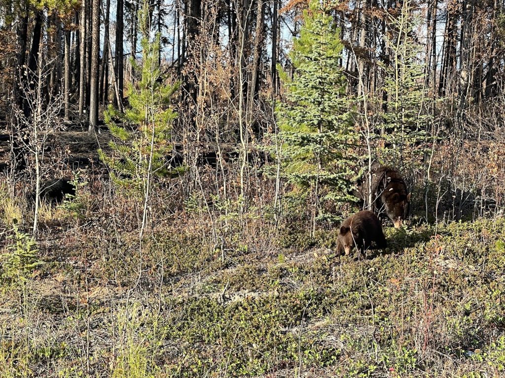
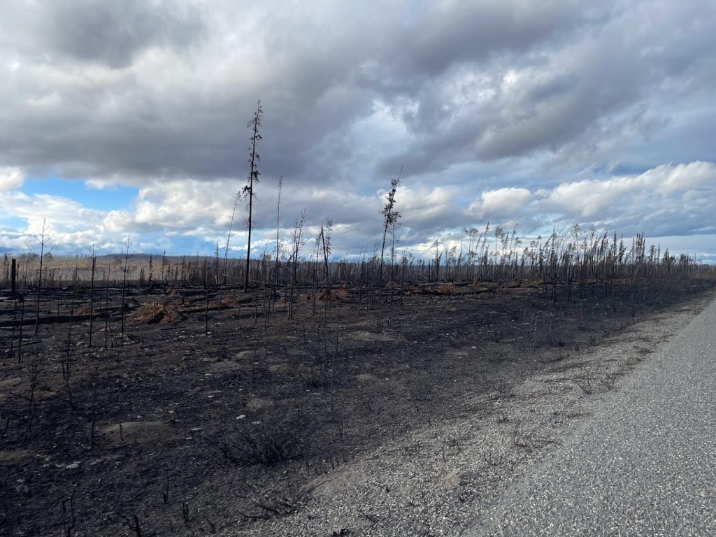
The Stewart-Cassiar Highway did not disappoint! We crossed the border from Yukon into British Columbia 3km down the highway. Not even an hour later, we pulled over to admire a mama bear and two cubs chowing down on berries. The fall colors and scenic views were incredible. We also passed extensive burn scars from recent fires that had closed the highway just a month ago. The smell of smoldering forest still lingered in the air and fields of charred land flanked the road for miles.
Heading down the Stewart-Cassiar HighwayMama bear and her two cubs chowing down on berriesBurn scars from recent fires along the Cassiar Highway that closed parts of the road in SeptemberBeautiful fall foliage along the Cassiar Highway
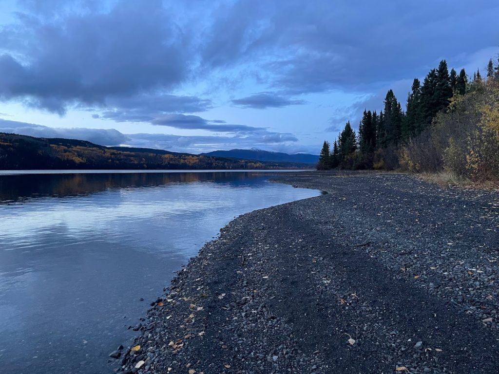
As the afternoon wore on, we were growing tired but luckily nearing our stop for the evening – the Sawmill Point Recreation site on the north end of Dease Lake. About an hour and a half away, we passed a beautiful campground at Tā Chʼilā Provincial Park (formerly Boya Lake) but opted to go a little farther and stick with our original plan to continue to Sawmill.
Beautiful views at the Tā Chʼilā Provincial Park (formerly Boya Lake)
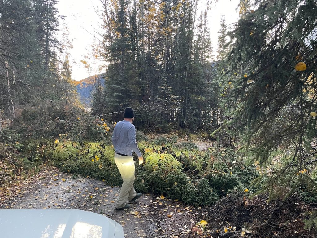
By 6pm Tuesday evening, we passed through several small communities including Good Hope Lake and Jade City before finally reaching the Sawmill Point Recreation site. It was a long and narrow dirt road, ultimately leading down to the northeastern shore of Dease Lake. As we approached the last stretch of road leading to the campground, a giant spruce tree lay across the road blocking our path. Great.
A giant spruce tree blocking the path to Sawmill Point Recreation site
All I could think about was how we should have stopped at the Tā Chʼilā Provincial Park we had scouted out earlier. We could have already set up camp, had dinner, and be soaking up the last light of the day in front of a campfire. Instead, here we were staring down a massive tree in the way and feeling tired, hungry, and defeated! The other campground was 90 minutes behind us and sunset was 30 minutes out. Total bummer! My first reaction was to turn around and find a different spot to camp for the night. Instead, Tim embraced the challenge at hand and insisted we “take a closer look” before deciding to turn around. Next thing I know, he pulled out a saw and hatchet from our toolbox and started analyzing the best way to clear the path so we could continue into the campground.
After chopping off some branches and sawing the tree in two places, we were able to clear a small path just wide enough for the car to pass through. It took all of the strength from both of us pulling together to drag the dense trunk to the side of the road. Who knew the Sawmill Point Recreation Site would actually live up to its name! Well it turns out the hard work was worth it. The campsite was beautiful – right on the lake! It was now 7:30pm and the last glow of light for the day illuminated the fall foliage along the lakeshore. Tim was thrilled to have conquered the tree, and luckily I snapped a picture capturing his elation in that moment. It’s a new favorite. What joy!
Our campsite for the night at Sawmill Point Recreation SiteElated, tree-conquering Tim!
Oh, and I’m sure there’s a lesson in there somewhere about persistence, overcoming obstacles, and using every available tool at hand to eliminate roadblocks – literally and figuratively. I hope one day in the future I look back on “tree day” and remember these important lessons.
On October 1, Tim and I packed up our car and left Anchorage. The last 2 weeks of September were full of packing, garage sales, cleaning out our apartment, squeezing in precious time with friends, and more packing. It was an exhausting week leading up to “go day”, but we made it. Sprinkled throughout these final days were mixed feelings of excitement followed by sadness, and occasionally outbursts of tears followed by laughter. Change is a strange thing, especially the anticipation of knowing you will miss something. But after seven and a half years, we feel ready for a change. We’re hopeful this adventure offers new experiences, opportunities for growth, and pushes us outside of our comfort zones!
Lots of time with friends during our final weeks in Anchorage. (Many more gatherings not pictured!)
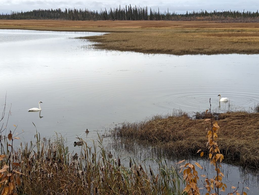
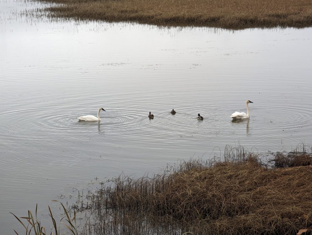
We made great time on Sunday and beat the snow & wind that was forecast to arrive across the Eastern Alaska Range and northern Copper River Basin. Darkness was already creeping in when we pulled into the Lakeview Campground just outside of Northway, AK. We parked at a perfect site right on the lake and were warmly greeted by several trumpeter swans. They were barely visible in the fading dusk light, but were sure to make their presence known.
Trumpeter swans visible on the lake Monday morning
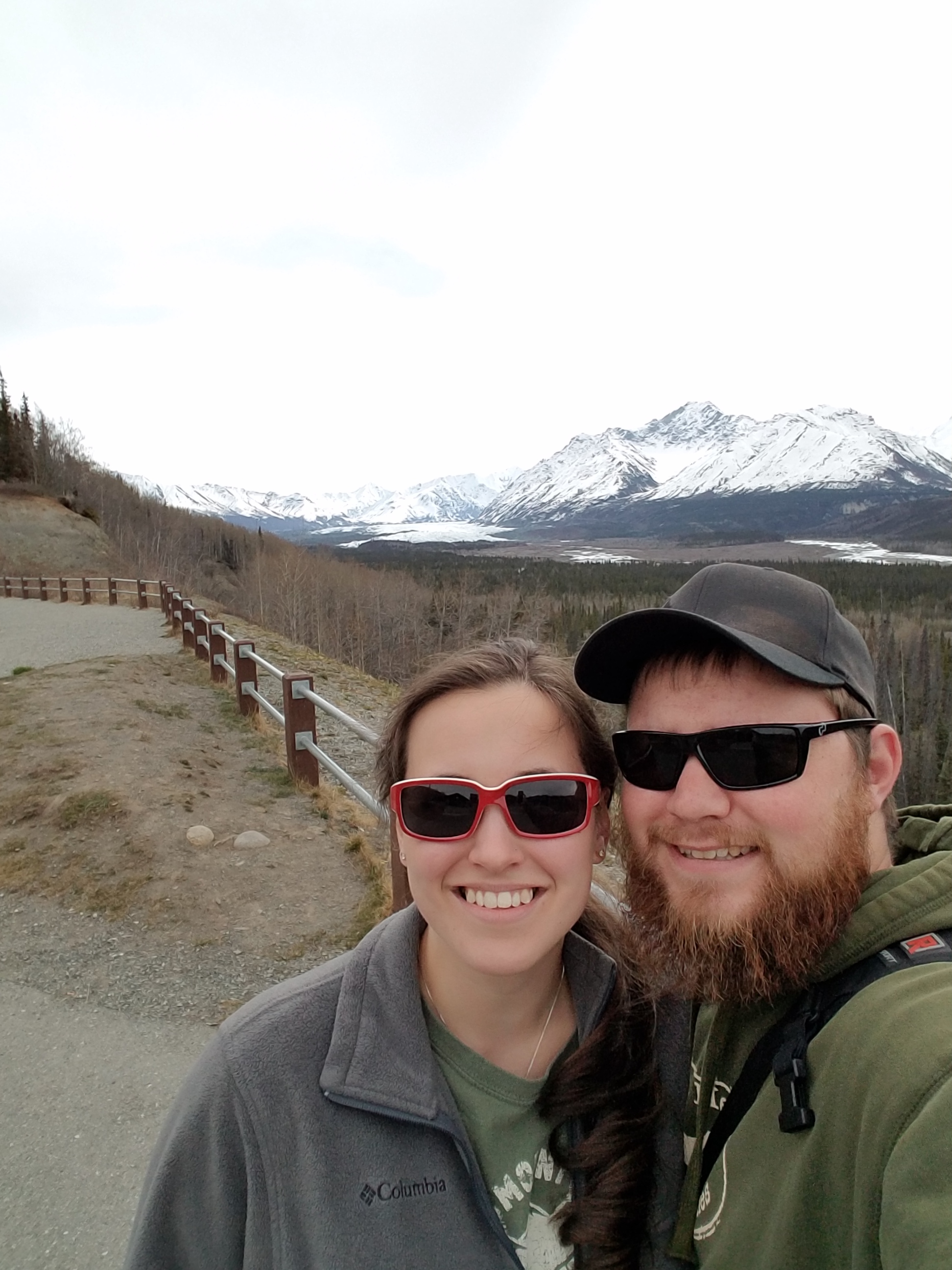
Monday morning we awoke to overcast skies and chilly temperatures. A layer of frost coated the ground. After a quick breakfast and coffee, we packed up and hit the road again. We crossed the border into Yukon around 10am and reached Kluane National Park and Kluane Lake by the early afternoon. The fall colors were amazing, and the views around each bend in the road seemed to outdo the last. The welcomed rays of sunshine highlighted the trees even more. Coupled with towering snow-capped peaks in the background, the scenery was truly mesmerizing. I’m not confident the pictures do any justice!
Crossing the border from Alaska into YukonThen & Now! Throwback to 2016 crossing the border into Alaska. (More on that here!)Views from Thechàl Dhâl Visitor Centre on the south side of Kluane Lake
We pulled into Whitehorse around 6pm and sampled local brews at Winterlong Brewing. The friendly staff recommended various campsites and we found a great spot halfway up Gray Mountain with views overlooking Whitehorse. After a long day of driving, we settled into camp with a hot meal and a game of cribbage. We were treated to a beautiful sunset, though knew the fair weather wouldn’t last long as rain was moving in!
Friendly staff and tasty brews at Winterlong Brewing in Whitehorse, YT
It was hard waking up Tuesday morning. Temperatures in the low 40s and the sound of steady rain certainly weren’t an inviting start to the day, but the lure of a local coffee roastery and bagel shop got us moving. We packed up and made our way into town for stops at Midnight Sun Roastery, followed by Bullet Hole Bagels. With full bellies, caffeine, and a full tank of gas, we got back on the Alaska Highway and drove towards Watson Lake.
The gloomy and rainy weather continued for most of the day; a stark contrast to the sunshine we had Monday. In the early afternoon, we stopped at Rancheria Falls, just a couple hours outside of Watson Lake. It was a great place to stop for lunch, and there is a short walk through the boreal forest to a boardwalk overlooking beautiful waterfalls.
Tim walking along the boardwalk at Rancheria Falls
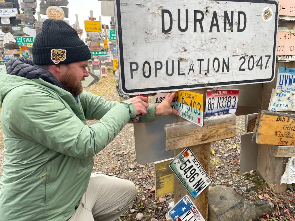
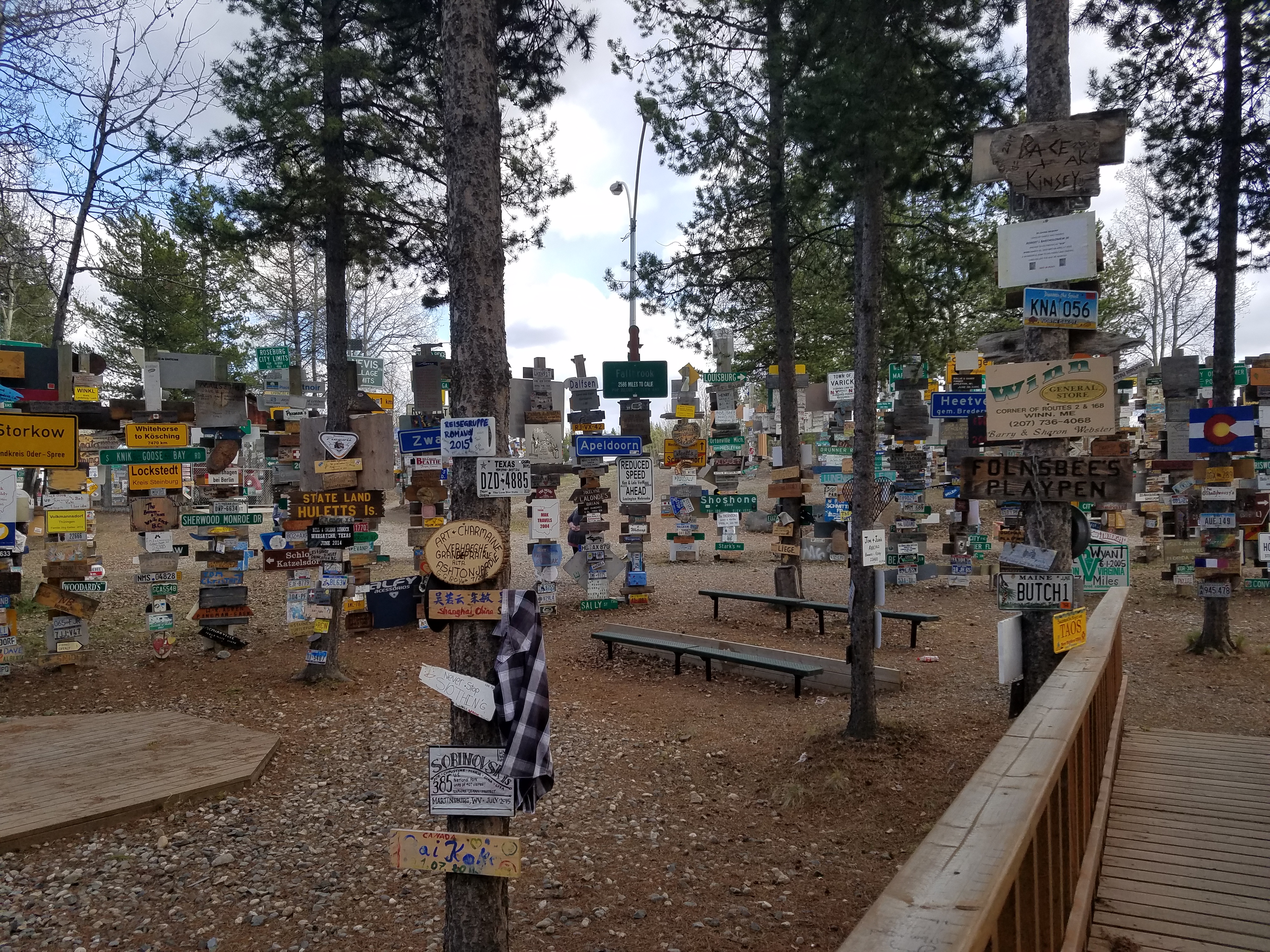
About an hour later, we reached Watson Lake. After a quick stop to gas up, we walked through Sign Post Forest to scout out a good place to leave our sign! Tim fashioned together a unique sign using two halves of license plates – one half Alaska and one half New Hampshire – to represent our time in both places and our journeys back and forth between Alaska and the East Coast.
We found a good spot to leave our mark and then backtracked slightly to get onto the Stewart-Cassiar Highway. Lots of miles driven, and almost into British Columbia!
After a great time in Nugget City Thursday night, we drove most of the day on Friday to reach Haines Junction, Yukon Territory. It’s a quiet little town with great mountain views. We lucked out again on another awesome place to stay – the Parkside Inn which had mountain views on the doorstep!
Parkside Inn – Haines Junction, Yukon Territory
Saturday morning, the clouds lifted revealing a great view of Kluane National Park and Reserve
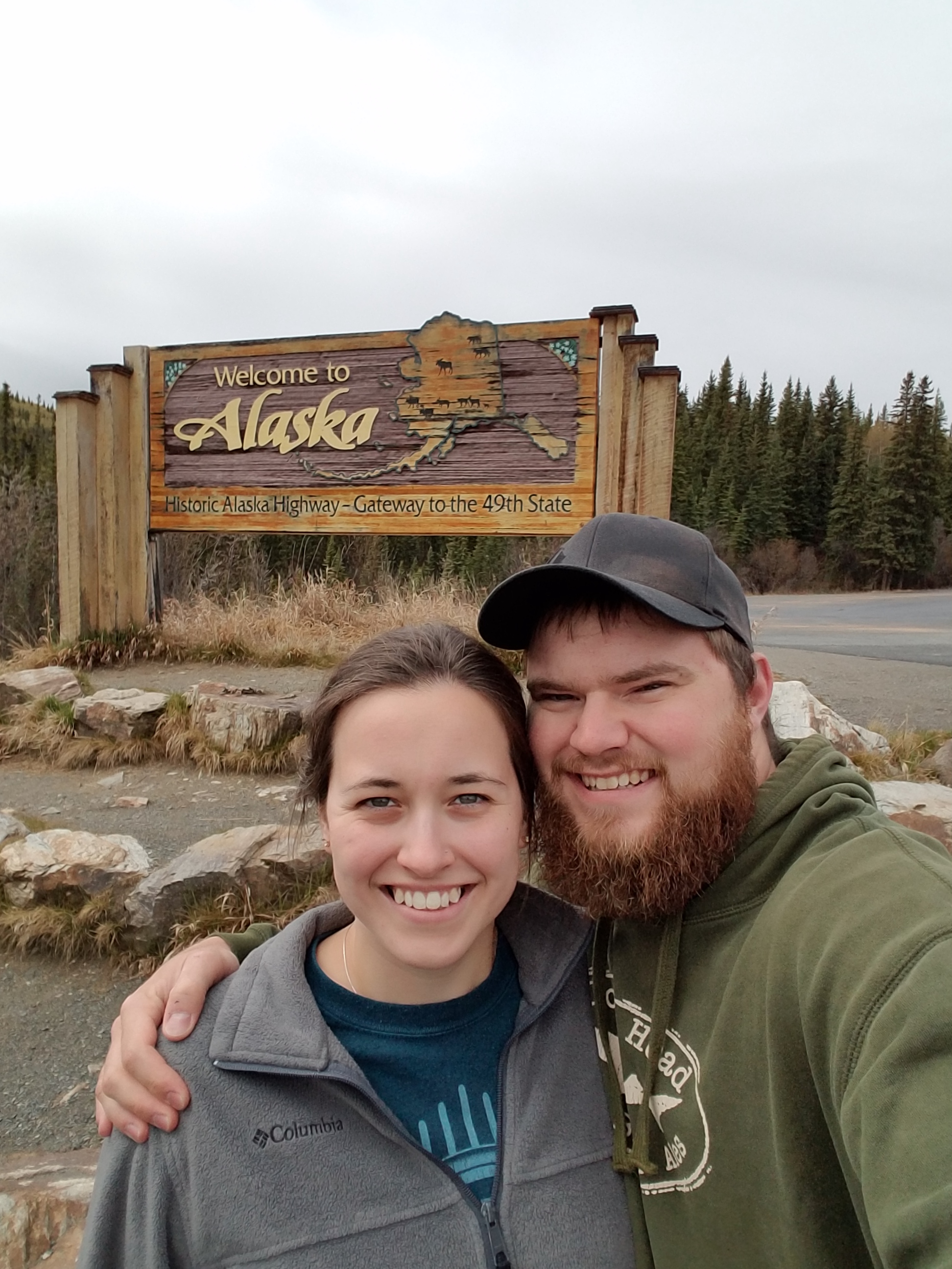
We headed out early Saturday morning to reach U.S. Customs just after lunch, and arrived in Tok, Alaska in the late afternoon. Woohoo, we made it!!
After over a week on the road, we finally reached the Alaska state line!
We checked into a hotel and had some great pizza at Fast Eddy’s, which we learned is a highly recommended place in the state.
Sunday was our last day of driving and we finally reached Anchorage in the afternoon! There were some spectacular views along the way, and we even passed a glacier that is only a 2 hour drive from the city.
Matanuska Glacier on the way to Anchorage
Beautiful mountains on the way into the city
We checked into our Air BnB place for the week (a great apartment not far from downtown!) and we’ve spent the last 24 hours looking for housing. It has certainly been a long road trip – but we finally reached our destination after 11 days, more than 5,600 miles, and over 240 gallons of gas. More importantly, there were so many incredible stops along the way and now we have a whole new state to explore!! We’ll be getting settled in over the next few weeks, but I hope to continue to update this blog on occasion as a way to share our adventures with family and friends.
Thanks for following along – cheers to adventure!!
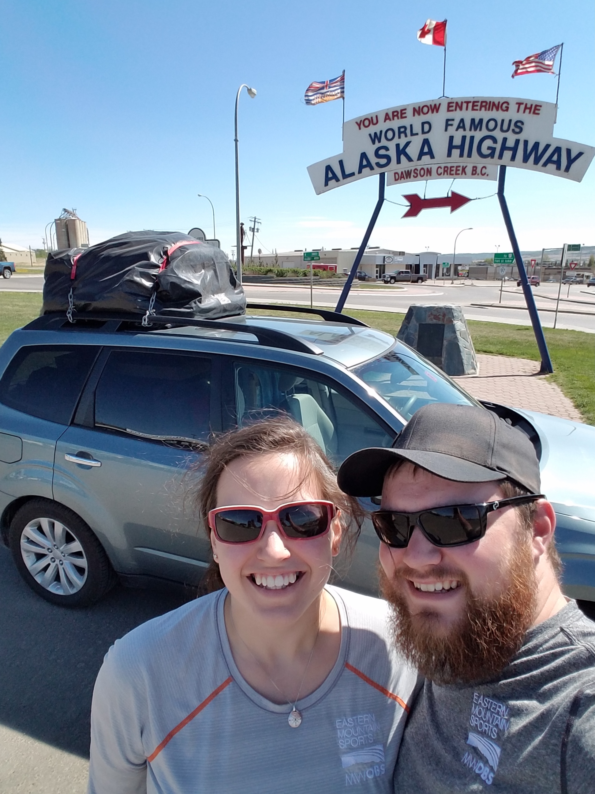
Wednesday morning we woke up early and left the Hinton Lodge in Hinton, Alberta. From there we drove most of the day reaching Fort Nelson, British Columbia by dinnertime. We reached Dawson Creek, BC (mile 0 of the Alaska Highway!) around 3PM MDT but gained an hour since Dawson Creek area runs on MST year-round.
Dawson Creek, BC – mile 0 of the Alcan!
A few things about the Alaska Highway (or the Alcan Highway as it’s also known) that I thought were really interesting and learned from the guidebook – it’s considered to be the largest and most difficult construction project since the Panama Canal. In 1936, FDR lobbied Canadian Prime Minister Mackenzie King for a highway connecting Canada to Alaska. His argument was that the highway could be used for military defenses on the west coast in the event of a Japanese attack. Well, nothing was done for a few years, but shortly after the attacks on Pearl Harbor both the US and Canada recognized the immediate need for this road to be built, so they quickly got to work. A plan for the road was constructed by the US Army on February 6, 1942 and it only took 5 days to receive authorization from Congress. Construction began on March 8, 1942 and was completed on November 20, 1942; less than 9 months later!! Just incredible. The strategy for completing the road in such a short time included 5 separate teams that worked in several different directions, eventually meeting each other along the way. Today, the road has been re-constructed and re-routed, but there are historical mileposts that mark the original highway.
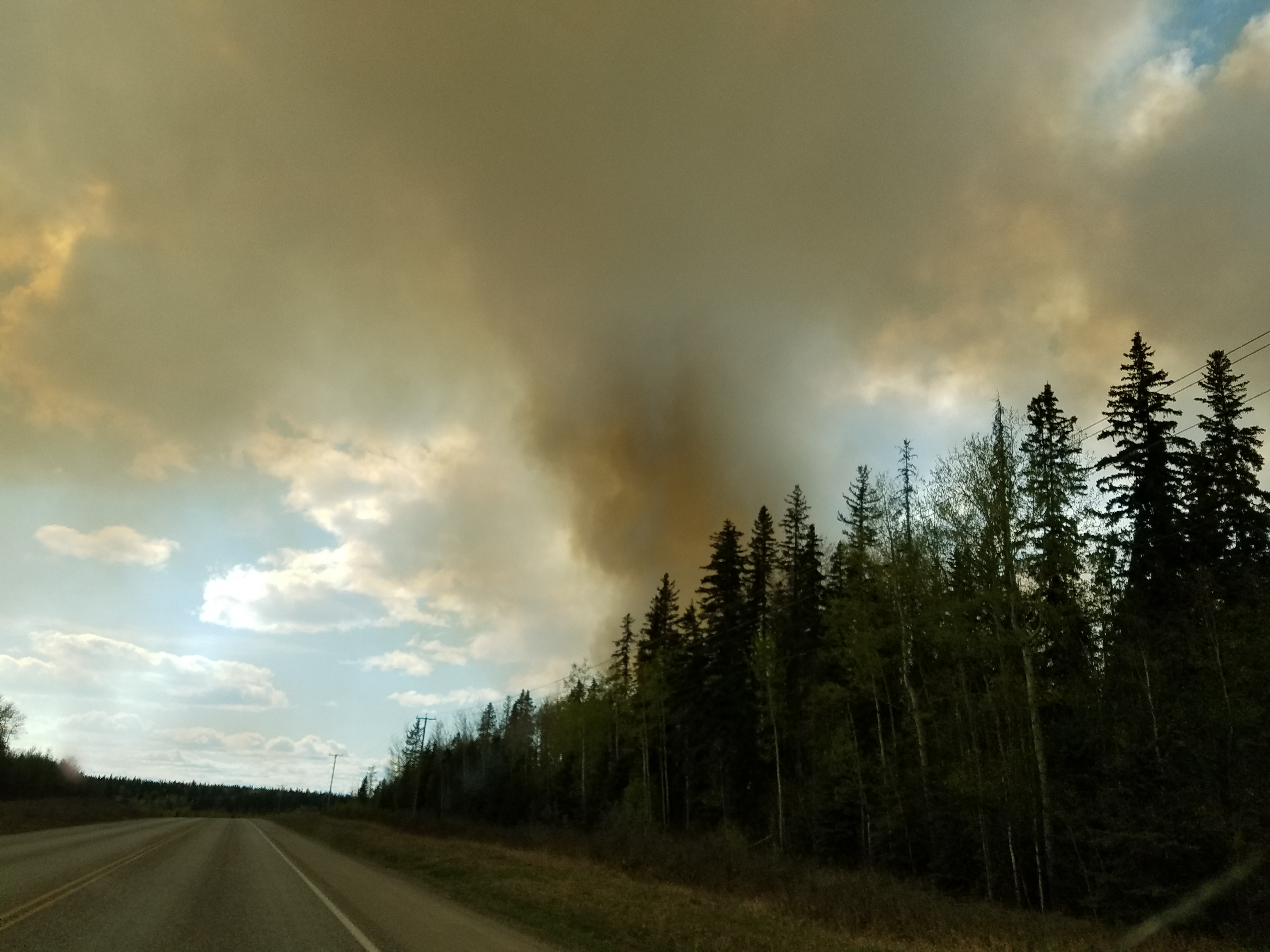
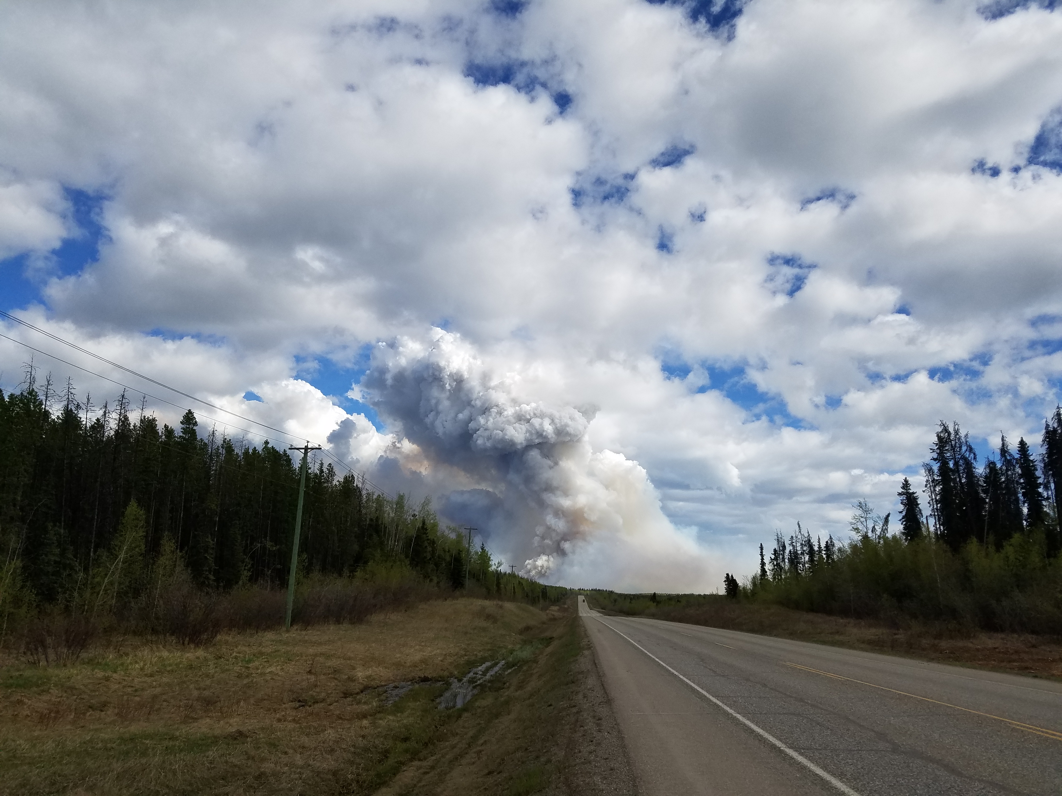
Eighty miles into the Alaska Highway, we saw a massive wildfire (later learned that it was the Beatton Airport Road fire) that was dangerously close to the road and we were surprised to see that traffic was still moving. The winds on Wednesday were incredibly strong all day which hindered the firefighting efforts. After looking up more information online, we learned that we got through the area just in time. That stretch of the Alaska Highway was shut down much of Thursday when the fire jumped the road. We also learned that the fire has been ongoing since mid-April (!) This fire is different from the Fort McMurray fire in Alberta, which as you can imagine is the top item of discussion among many Canadians.
Plumes of smoke seen from a distance
Beatton Airport Road fire along the Alaska Highway, British Columbia
Looking back after passing the fire
After another five hours of driving, we stopped for the night in Fort Nelson. As luck would have it, we were given an upgraded room with in-unit laundry!! We were so excited to wash our clothes. Funny how the simple things can make you so happy! The days have been getting longer and longer each day as we travel north. Wednesday night at 10PM, there was still a glow on the horizon. Guess we better get used to that!
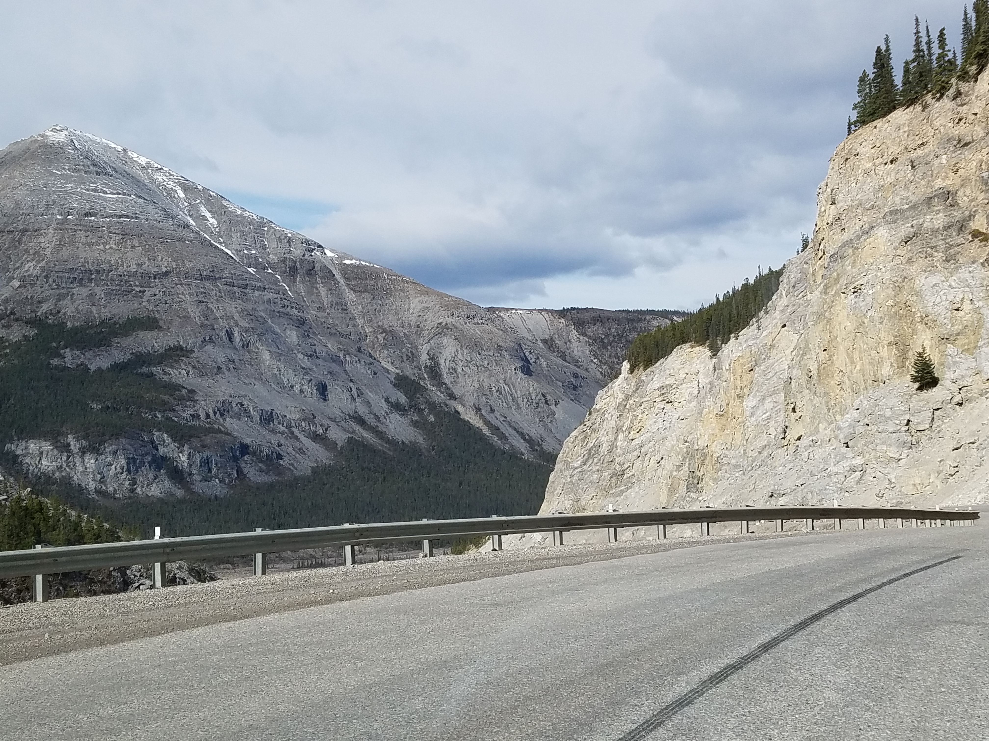
After a great night’s sleep in our fancy in-unit laundry suite, we got back on the Alaska Highway Thursday morning. We drove through Stone Mountain and Summit Lake Pass, which is the highest point along the highway (4,250 feet).
Stone Mountain, British Columbia
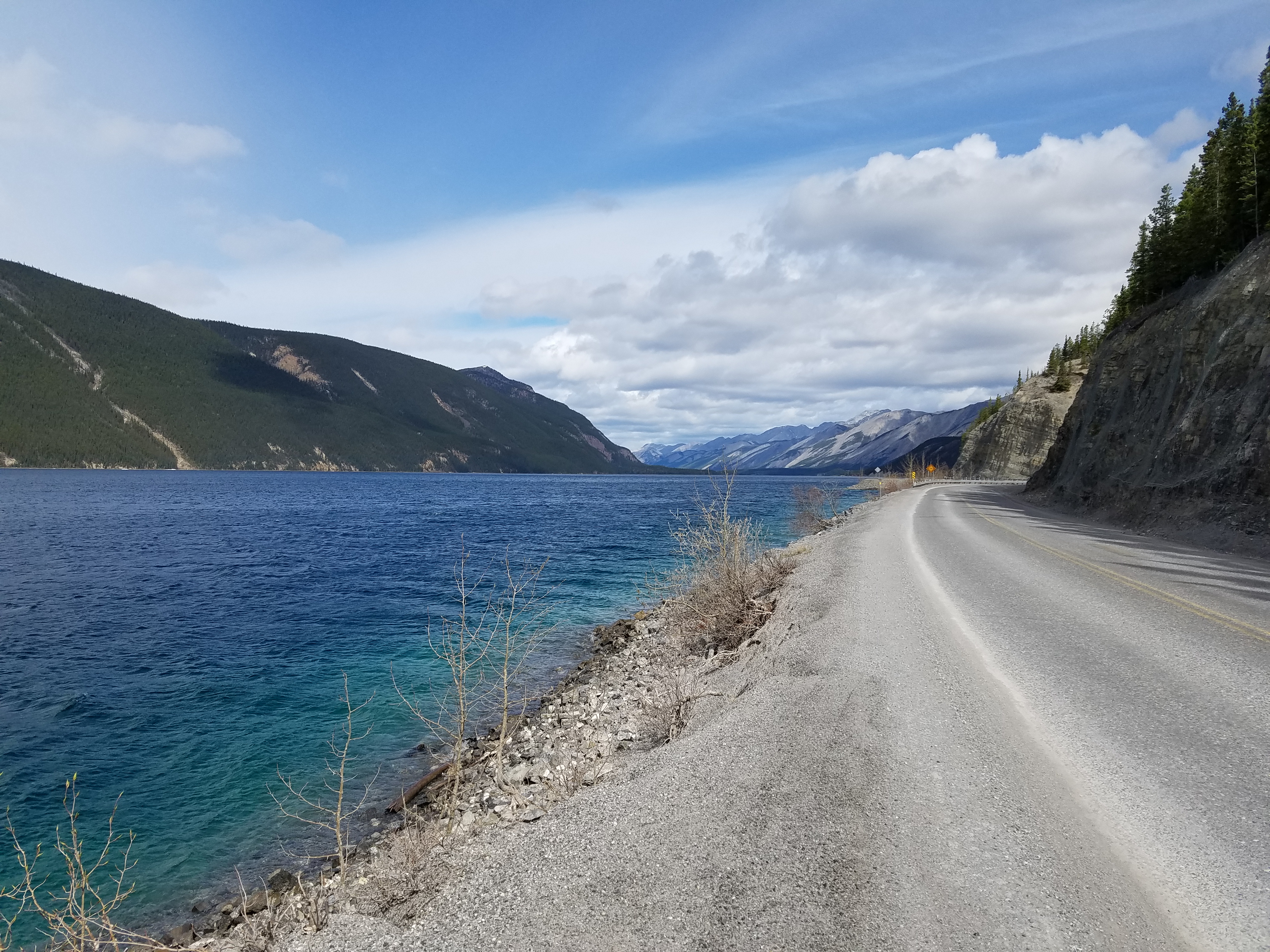
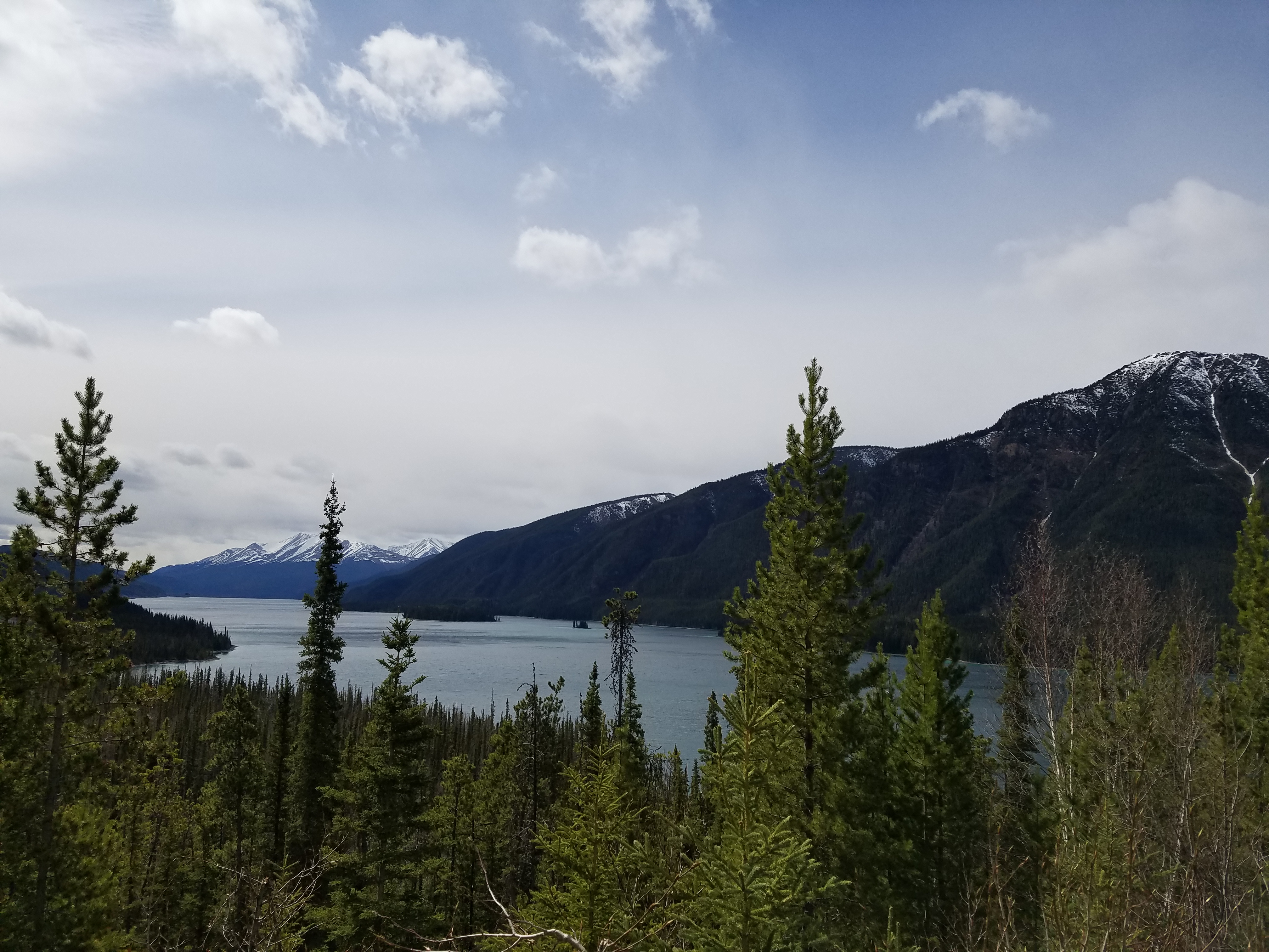
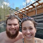
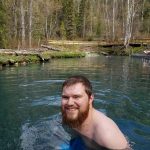
Shortly after noon on Thursday, we reached Muncho Lake Provincial Park and spent some time there taking in the scenery. Then it was onto the Liard Hot Springs which has been the best part thus far!
Muncho Lake, British Columbia. So beautiful – the color of the water is attributed to leaching of copper oxide.
View of Muncho Lake from the northern end
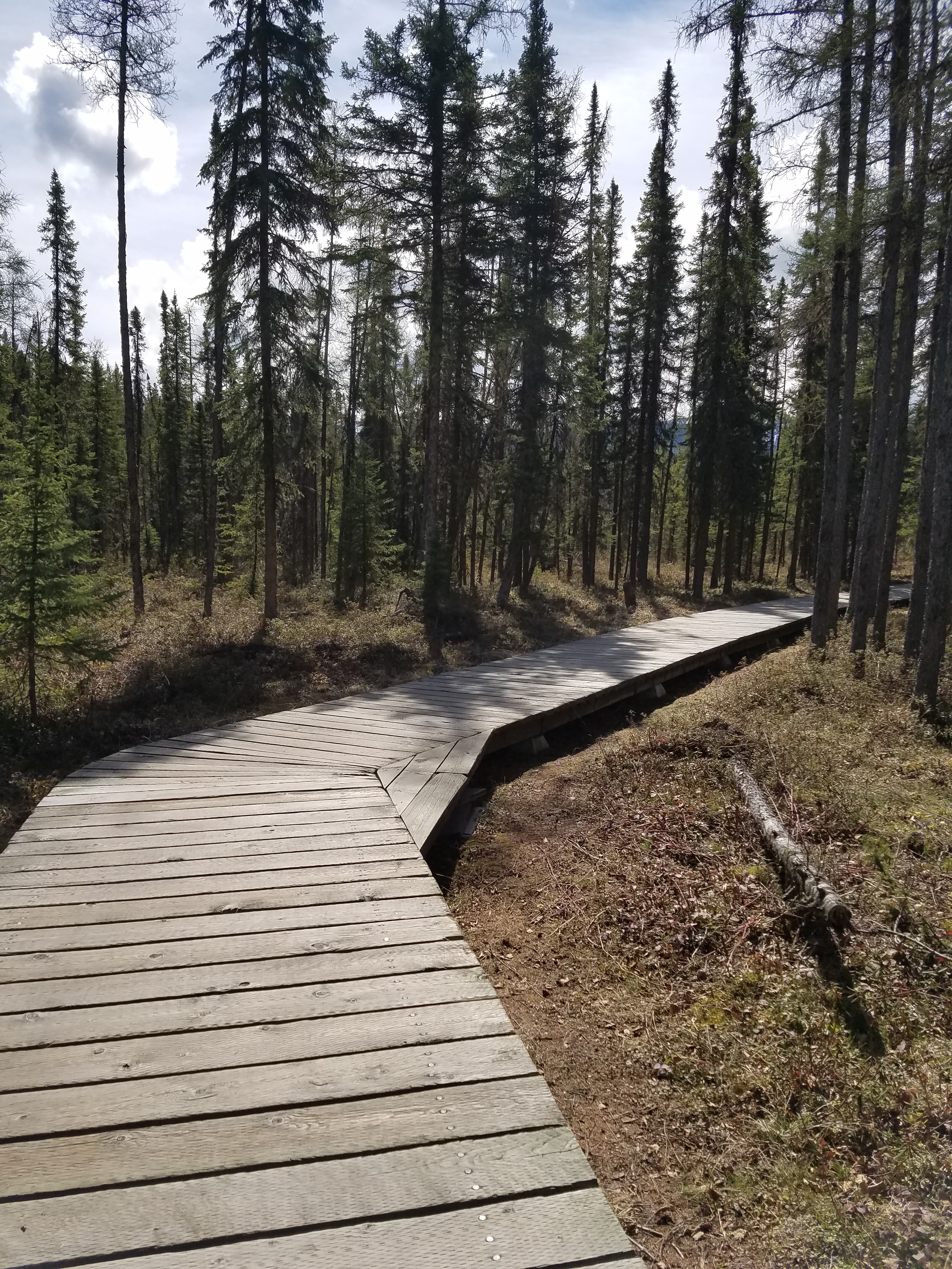
Boardwalk leading out to Liard Hot Springs
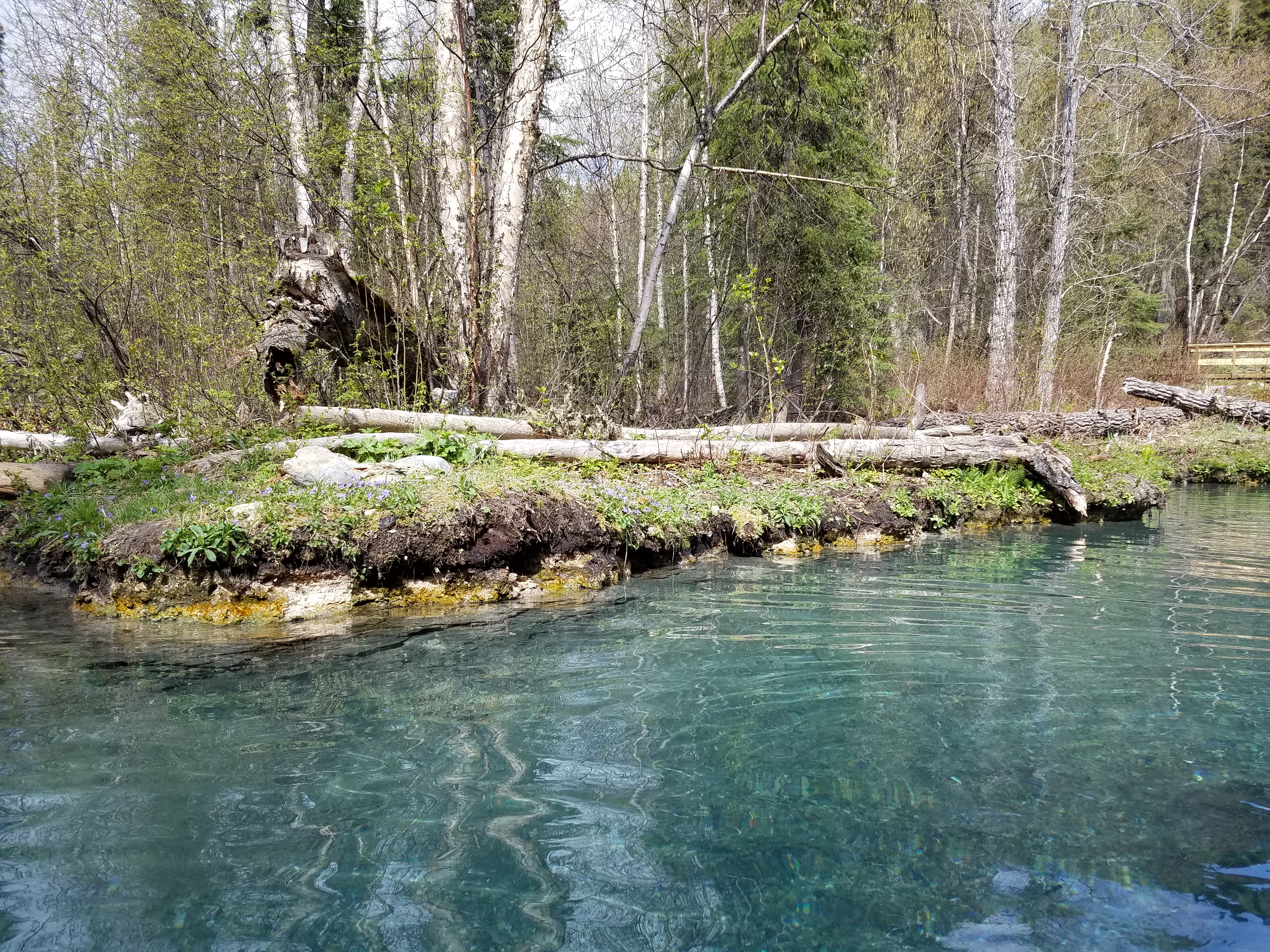
Beautiful! Wouldn’t this be a great backyard!?
The perfect rest stop for a long day on the road!
Tim enjoying the 104 degree (F) water
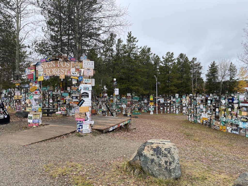
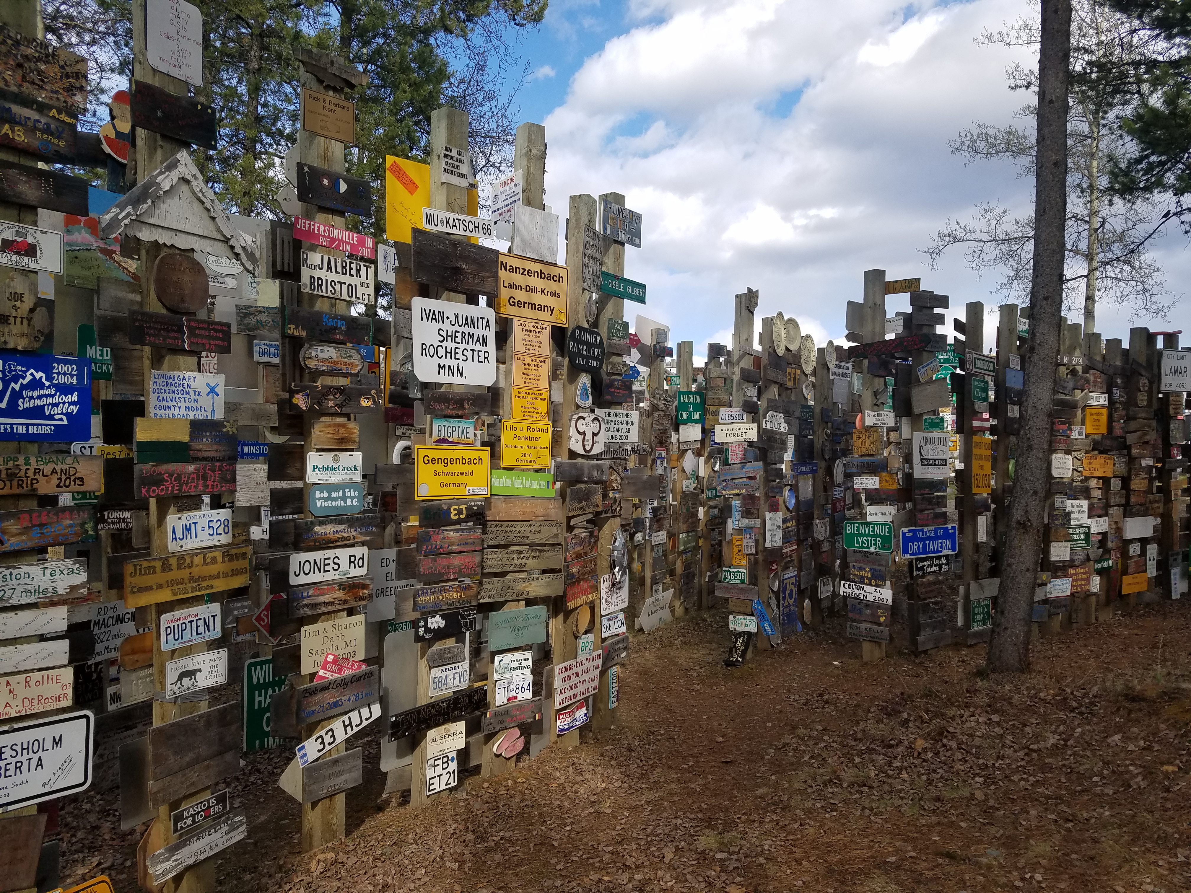
Another few hours of driving brought us to Watson Lake, Yukon. We grabbed a quick lunch at Kathy’s Kitchen and upon departing the gravel driveway, a rock got stuck in the front left brake. Well, we didn’t know it was a rock at first and got worried that there was a bigger problem, but a lady across the way who just happened to work for her uncle’s garage spotted us inching it forward a bit, looking under the car, listening, and yelled out to us saying, “It’s just a rock in your brakes, come on over and we’ll fix you up!” Gotta love the super friendly people around here! While operation remove-the-rock was underway, Tim and I walked over to Sign Post Forest. It’s a pretty cool place and the signs go on forever. As the story goes, a homesick GI named Carl Lindley was working on the Alaska Highway, and after recovering from an injury in Watson Lake, he was tasked with repairing some of the distance signs to surrounding towns. He then decided to put up a sign in the direction of his hometown, Danville, Illinois, and Sign Post Forest was born! Today over 72,000 signs have been added from all over the country and the world. We also learned that the locals call it the “Largest Public Collection of Stolen Property” haha!!
Sign Post Forest in Watson Lake, Yukon
Signs everywhere!
After we returned to the car and thanked the people at the garage, we decided to stay in a cute cabin in Nugget City, 20 minutes away from Watson Lake. We wandered over to the restaurant next door, “Wolf it Down”, and split a bison burger. We also met the great owners, Scott and Linda, and the cook Dave. They told stories of their travels and a couple of guys in the Army on their way to Anchorage as well asked some questions about how cold it gets in the Yukon area. Scott the owner responded, “Oh, about -40. You just don’t do anything strenuous, ya know, don’t go out chopping wood because next thing you know you take a deep breath, your lungs freeze, and you drop dead!” Hahaha!! Tim and I were laughing so hard. We had such a great time, what a fun place!
After checking out of the Mountain Pine Motel (we were the first customers of the season!), we spent the majority of Monday morning exploring Glacier. It is absolutely beautiful! A lot of the roads were only open to certain points, so we only saw a fraction of the park but what we did see was awesome. I’ll let the pictures speak for themselves!
Wild horses spotted near St. Mary, Montana
St. Mary Lake, Glacier National Park
Lake Sherburne, Glacier National Park
We crossed the border into Canada around 1PM and stopped in Calgary for a late lunch. We hit some rush hour traffic outside of Calgary which put us behind, but we still reached Banff by 7 or so.
On the highway approaching Banff
After checking into our hotel, we walked around and explored the town. It reminded me a lot of North Conway with a Colorado twist! After stopping for a beer at the Banff Brewery, we called it a night.
View driving into downtown Banff
It’s hard to find the words to describe Banff National Park. It’s absolutely incredible. We had never even heard of it before until our friend Ashley tipped us off, insisting we should stop there. I’m so glad we did (thanks Ashley!). We drove along the entire Icefields Parkway north to Jasper, and around every turn was an incredible scene. We made as many stops as we could, but you really need at least a week or two to have adequate time to see everything. I’m hoping we’ll be back sometime soon!
Johnston Canyon Lower Falls, Banff National Park
Morant’s Curve
Panorama of Lake Louise
Panorama of Waterfowl Lakes
Saskatchewan River Crossing
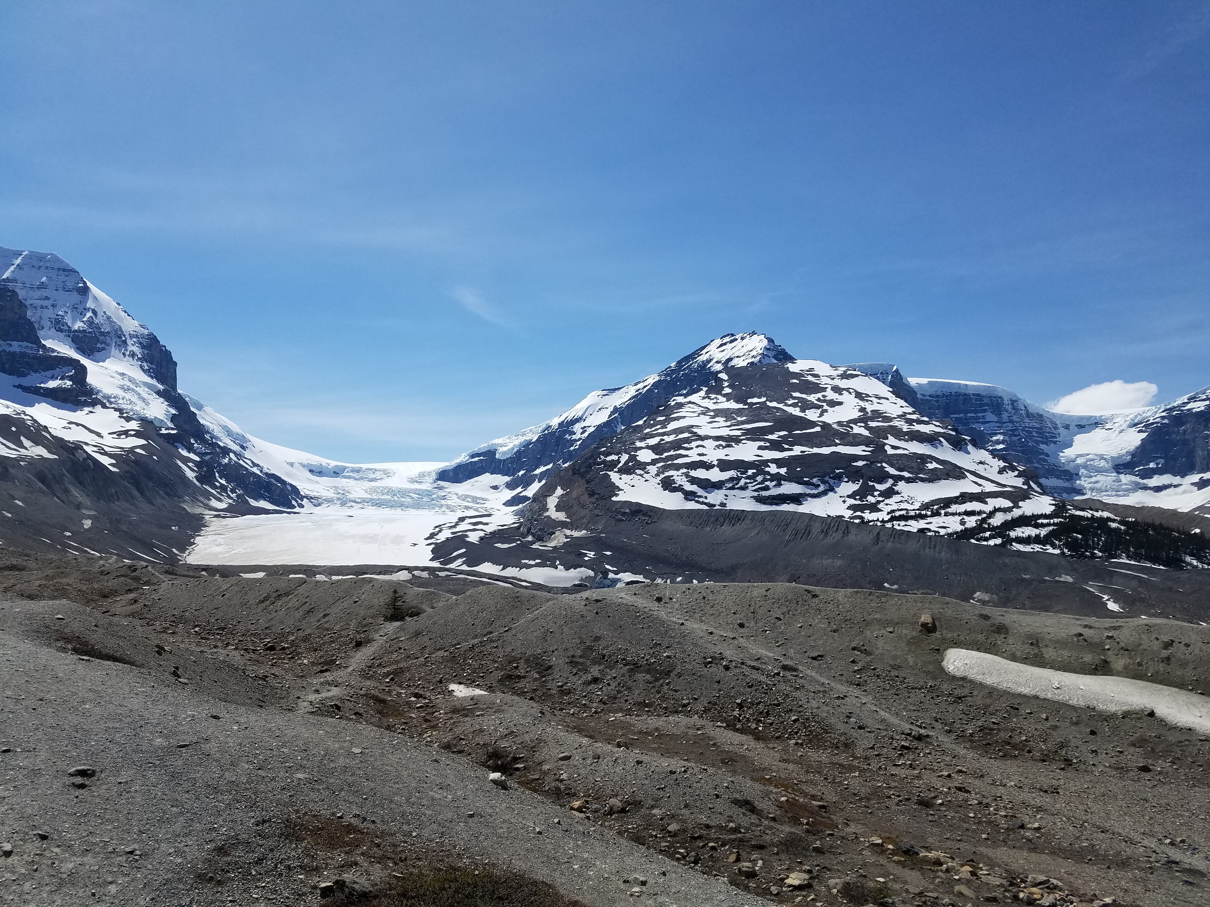
Panorama of the road leading up to the Columbia Icefield
Columbia Icefield & Brewster Glacier in Jasper National Park
Tomorrow we’ll be getting on the Alaska highway. We’ve plugged over 3,700 miles and stopped for gas 14 times so far, but we’re more than halfway there now – only 1,860 miles to go!
If there’s any state that makes you feel small, it’s South Dakota! The land goes on for miles, and it’s amazing how the topography changes dramatically once you cross the Missouri. Tim and I arrived at my cousin Bobby’s house in Eagle Butte around 6 on Friday night. We had a blast hanging out with Bobby, his wife Pete, and their friends Monty, Brad, and Troy.
Saturday morning, we left around 10 and headed to the Minuteman Missile National Historic Site. Unfortunately, the next tour was at 2PM and we didn’t have time to wait around, but they did have a visitor center with a brand new museum that was worth the stop.
From there, we hopped onto the Badlands Loop; lots of spectacular views along the way, and even some wildlife sightings!
Bighorn sheep
Next stop was Rapid City. Bobby and Pete met up with us for an early dinner at the Firehouse Brewing Co. and then we were on our way into Wyoming.
After a quick visit to Devil’s Tower, we made our way to Buffalo where we stayed at the Occidental Hotel, per Bobby’s suggestion. It really is an awesome place if you ever find yourself in the area!
The Occidental Hotel, founded in 1880
We got back on the road this morning by 8:30 and arrived in East Glacier Park Village, MT by the end of the day. While we were hoping to stop at Yellowstone along the way, unfortunately a lot of the roads were still closed on the eastern and southern sides, and driving around to the western side would have been 6+ hours out of the way, so we’ll have to save that for another trip! Nevertheless, the drive through Montana was beautiful, with continuous views of mountains in the distance.
We took a quick drive through Glacier National Park while the sun was setting, and we’re hoping to go back tomorrow when we have more time to explore. Then we’ll be on our way into Canada! Next stop: Banff National Park.